


I arrived in Lauterbrunnen on an early July morning with a familiar photograph already in my head: Staubbach Falls hanging above the church, tour buses idling by the main road and phones held high in the air. Switzerland Tourism calls this a valley of 72 waterfalls, but most visitors never walk far beyond that first iconic frame. I wanted to know what actually happens to the landscape, the noise and the crowds once you keep following the water south, all the way along the valley floor.
The exact route I walked through the waterfall valley
This walk took place in the first week of July 2025, during a spell of stable summer weather after several days of rain had swollen the falls. I started at Lauterbrunnen railway station at 9:15 in the morning, when the platform was still cool and shaded by the cliffs. From the station (914 metres above sea level) I followed the main village street for a few minutes, turned right at the church towards Staubbach Falls, then continued along the signposted valley path towards Stechelberg, keeping the Weisse Lütschine river on my left.
From Staubbach Falls the route stayed almost flat along a mix of gravel farm track and paved lane through the meadows on the western side of the valley. I passed the camping grounds and small farms between the village and Trümmelbach Falls, crossed the access road near the Trümmelbach car park, then rejoined the riverside path. Beyond this point I continued south to Stechelberg, finishing at the bus stop and cable car valley station below Mürrenbach Falls. The same path returns to Lauterbrunnen, and I walked back along it in the late afternoon, staying on the opposite side of the river for part of the way where local signs allowed.
Measured on the yellow Swiss hiking signposts and confirmed against the Jungfrau Region summer guide, the one-way distance from the station in Lauterbrunnen to the bus stop in Stechelberg is published at about 8 kilometres, with roughly 160 metres of gentle ascent and 50 metres of descent along the way. In practice the terrain feels almost level, and I covered the outward walk with photo stops in just over 2 hours, then took a little under 2 hours to come back in softer evening light. Walking both directions, detouring into Trümmelbach Falls and pausing for a simple lunch in Stechelberg, the total time on my feet was around 6 hours, easily filling a relaxed full day without ever needing to rush.
The waterfalls I actually reached on this walk were Staubbach Falls, the series of interior cascades at Trümmelbach Falls, several seasonal streaks and ribbons unnamed on the maps, and finally Mürrenbach Falls at the head of the valley near Stechelberg. Together they turned the marketing promise of “72 waterfalls” from a slogan into something visible and audible all day long, even when only a few carried official names and footpaths.
Leaving Staubbach Falls and the village behind
Staubbach Falls makes a dramatic starting point, but it is also the busiest and most constrained part of the valley. At 9:30 the path up to the Staubbach viewpoint already held a loose queue of visitors waiting their turn at the metal staircase. The waterfall is 297 metres high, but by the time the water reaches the air above the village it has broken into a drifting cloud of spray. In strong wind it feels like standing inside a fine rainstorm; on still days in summer the droplets fall almost vertically and coat your jacket with a cold sheen within seconds.
Just beyond the car park the atmosphere changes quickly. Within ten minutes of leaving the viewpoint I was walking between pastures bordered by low electric fences, with the village noise thinning behind me. The cliffs still rose in the same vertical walls, but the soundtrack shifted from tour bus engines and camera shutters to cowbells, the heavy white noise of the river and the distant hiss of water on rock. It was here, not in front of the church, that Lauterbrunnen first began to feel like a valley of waterfalls rather than a village under a single famous one.
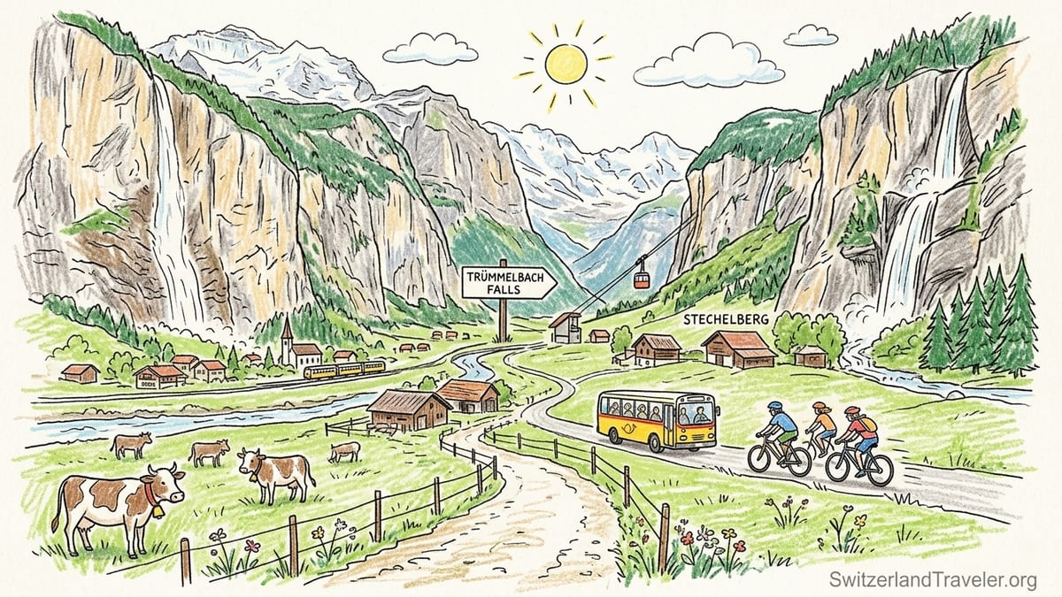
Traffic does not disappear completely. For the first half-hour I heard the yellow postbuses that shuttle between Lauterbrunnen, Trümmelbach and Stechelberg every 30 minutes during the day. On some short stretches near the campgrounds the pedestrian path runs just a few metres from the road, and the bus can momentarily overpower the sound of the river. However, where the path swings closer to the Lütschine the vehicles fade into the background, and long pieces of the western bank feel more like a farm road than a traffic corridor.
The sun in early July had already cleared the cliff tops by mid-morning, but the depth of the valley means light behaves here in unexpected ways. One shoulder of the valley still sat in shadow while the opposite wall blazed in full sun. As the morning passed, the shadow line slid across the fields, so that at times I walked in cool shade with bright meadows directly opposite, then later in warm light watching the far trail retreat into blue-toned shadow under the cliffs.
Following the river and sharing the valley with bikes and buses
The valley floor route uses a combination of marked hiking path and small service road, and this mix shapes how the walk feels underfoot. Between Lauterbrunnen and Trümmelbach Falls the surface is largely compacted gravel with occasional paved sections near farms and campgrounds. It is suitable for trainers rather than technical boots, and families with pushchairs and cyclists use it as much as hikers. The path is categorised as an easy walk by both Switzerland Tourism and local trail guides, and after walking the full distance in both directions I agree; the route is long enough to reward an afternoon, but it never feels physically demanding.
Bicycles are increasingly part of the valley experience. On my walk I met e-bike renters from Interlaken and Wengen gliding quietly past at a steady pace. Most slowed politely behind me on narrower sections, but a few arrived quickly and silently from behind, especially around blind bends near farm buildings. Anyone walking with children needs to be aware of this shared use. The official path is wide enough in most places for walkers and cyclists to pass side by side, yet the emotional tone of the day shifts depending on who you are sharing it with: a group of three bikes chatting quietly as they roll past feels different from a cluster of social media photographers stopping abruptly in the middle of the path to capture a particular angle on the river.
Postbuses frame the rhythm of human movement in the valley. Their stops at Lauterbrunnen, Trümmelbach and Stechelberg mark the practical escape points from the walk. I passed the Trümmelbach stop mid-morning and saw groups leaving the bus with tripods and waterproof jackets, heading for the ticket office. The bus engines are noticeable near stops, but once you are 100 metres down the path, the river and waterfalls reclaim the soundscape. Knowing that a bus departs Stechelberg several times each hour also means you can walk the valley in one direction and ride the other if the weather turns or your energy dips, making this one of the most flexible day walks in the region.
Despite the presence of vehicles, much of the day felt surprisingly quiet. On the return leg, leaving Stechelberg around 5 p.m., I often walked several minutes without seeing another party. Local hikers seem to time their outings to the buses, and when one group has dispersed from a stop, the in-between sections of the path can feel almost private, especially as the daycrew of visitors head back toward the village restaurants and train connections.
Waterfalls along the way and which detours are worth it
Staubbach Falls may be the most photographed, but it is not the only waterfall that matters along this route. As I walked south, the valley walls showed thin silver streaks of meltwater, some dropping straight from snow patches, others fanning out in veils over the rock. Most of these do not have formal names on the hiking map, yet they contribute to the sense that the cliffs are constantly leaking and breathing water. In early July the volume of flow was high, thanks to both snowmelt and recent rain, and almost every side gully carried some visible water.
The most significant detour is into Trümmelbach Falls, about halfway between Lauterbrunnen and Stechelberg. Here the water of the Jungfrau region’s glaciers forces its way through a narrow slot inside the mountain, thundering through a series of ten interior cascades. Reached by a short, signposted road branching off the main path, it adds roughly 30 minutes of walking time plus however long you wish to spend inside. Admission in 2025 was a little under 15 Swiss francs for adults and about half that for children, paid at the gate before taking the combination of lift and stairs into the mountain.
On my visit, the volume of spray inside Trümmelbach was intense. Water echoed off the rock in a low roar that made conversation difficult, and the spray collected on handrails, steps and clothing. The temperature dropped several degrees compared with the sunlit path outside, and the damp air made the tunnels feel almost autumnal even though I had left a bright summer meadow only minutes before. This was the one place on the walk where waterproof layers and sturdy footwear mattered. For me, the detour was entirely worthwhile. It transformed the waterfalls from a view to an immersive physical experience, and afterwards the lighter, more decorative streaks on the valley walls felt like part of a spectrum rather than isolated sights.
At the far end of the valley the reward is Mürrenbach Falls, which plunges several hundred metres down the eastern wall near the Stechelberg cable car station. Unlike Staubbach and Trümmelbach, Mürrenbach does not ask you to climb or pay to appreciate it. You simply walk into Stechelberg, glance up beyond the parking area and see a high ribbon of water stepping down the rock in several tiers. In the late afternoon the sun sat low behind me, catching the spray in a faint halo. The fall is set back from the path, so you do not feel its spray, but its scale makes a quiet impression, especially when you realise that this is one of the highest waterfalls in Switzerland and yet usually an afterthought compared with its more famous neighbour at the other end of the valley.
Weather, light, spray and how the valley feels on your skin
Weather shapes this walk as much as geography. On my July day the temperature in Lauterbrunnen when I set out was around 18 degrees Celsius, rising to the low twenties by early afternoon. The valley’s orientation, however, means that perceived temperature can swing quickly between sun and shadow. In the shade of the cliffs, especially close to the river, the air felt several degrees cooler, and long sleeves were comfortable early in the day even though forecasts for Interlaken, only a short train ride away, warned of heat.
Staubbach Falls is the place where you first feel water in the air. Approaching the viewpoint, my glasses fogged slightly as a sideways gust blew the spray out into the field. The droplets there are so fine they seem to hang rather than fall, and they catch the low sun in morning and evening. It is easy to see why so many visitors focus their entire valley experience on that single view. Yet spray appears in different forms elsewhere. Inside Trümmelbach, the impact of water on rock sends visible clouds of mist up the stairwells, while outside in the open valley, some of the thinner falls break into dust before they ever reach the bottom, leaving damp streaks but little visible movement where they land.
Sun and shadow play a particular role in the afternoon. Between Trümmelbach and Stechelberg, much of the western side of the valley fell into shade by 3 p.m., while the eastern wall still carried bands of golden light. This created a contrast between the warm, illuminated cliffs opposite and the cooler, bluer tones on the path I was walking. By the time I began the return journey, the light had rotated enough that Staubbach was backlit from behind, turning its “dust stream” into a glowing curtain whenever the breeze lifted it away from the rock.
Overall, the route itself never felt strenuous. The published elevation gain of around 160 metres across 8 kilometres is spread so gently that I noticed it more in my breathing when I increased my pace than in any specific hill or ramp. The surface is mostly friendly to knees and ankles, with only a handful of short, steeper ramps near bridges or road crossings. In terms of physical effort, the biggest challenge is cumulative time on your feet rather than steepness, which is part of what makes this walk accessible to such a wide range of visitors.
Food, toilets and practicalities between farms and cliffs
Despite the wild drama of the cliffs, this is not a remote alpine hike. Facilities punctuate the route in a way that makes planning a half or full day very straightforward. Public toilets are available at Lauterbrunnen station and near the car park for Staubbach Falls. Further along, Trümmelbach Falls has its own facilities for ticket holders close to the entrance, and Stechelberg provides restrooms near the cable car station and bus stop. Several campgrounds and small cafés along the way also serve customers, though some restrict facilities to paying guests.
Food options reflect the dual identity of the valley as both working farmland and major tourist corridor. In Lauterbrunnen you can pick up picnic supplies from the village supermarket or bakery before setting out, which I did, packing sandwiches, fruit and water. Prices for basic items like bread and cheese are in line with Swiss supermarket norms rather than restaurant menus, making this the most economical approach if you plan a full day outside. Along the path I passed a small farm stand selling local cheese and yoghurt from an honesty box system, and a campsite kiosk offering coffee, soft drinks and simple snacks such as pretzels and ice cream.
At the Stechelberg end of the valley there are a couple of restaurants and guesthouses where you can sit down for a hot meal with views back along the cliffs. I chose a small terrace near the cable car station, ordered a bowl of soup and a drink, and watched the Mürrenbach Falls while resting my feet. Prices were recognisably Swiss, with a simple lunch and non-alcoholic drink coming to the equivalent of a modest restaurant meal in a western European city. The advantage is that by the time you arrive here you have earned the pause, and the bus stop just meters away provides an easy backup option if you no longer feel like walking the return leg.
Water is an important consideration. There are some public fountains in Lauterbrunnen where you can refill bottles before leaving, and I topped up again at a campground tap with permission from the owner. On a mild July day I drank around two litres during the full walk; on a hotter day or with more strenuous detours into the side valleys you would want more. Shade exists at various points thanks to overhanging cliffs and small groups of trees, but much of the path between villages is open to the sky, and sun protection makes a noticeable difference to how much energy you have left by afternoon.
When reality clashed with social media, and when it quietly exceeded it
The most obvious gap between online expectation and my experience came at the first viewpoint under Staubbach Falls. Countless images show a lone visitor standing before the arc of water, framed neatly between church and cliff. On the ground at 10 a.m. in July, that composition required some effort. The path was busy, with people stepping into and out of each other’s frames, tour groups waiting for their allotted few minutes at the fence and drones buzzing overhead despite local notices asking visitors not to fly them. The sense of solitary awe suggested by many photographs was real in the physical landscape but harder to access emotionally amid the jostling for the best angle.
Inside Trümmelbach I also found a less polished reality than expected. Many videos online present an almost meditative experience of water and rock, set to soft music and careful editing. The real sound is closer to industrial noise, a deep pounding echo that vibrates in your chest. The metal steps can be slick with spray, and in peak hours the narrow walkways feel tight as people swap places between viewing niches. I did not find it unpleasant, but it was far rawer and more chaotic than the slow, graceful sequences that populate social feeds.
On the other hand, a quieter stretch of the valley quietly exceeded every image I had seen in advance. Between the last campground and the turn-off for Trümmelbach, the western-side path veers away from the road and hugs the river. In the early afternoon a breeze funneled down the valley, carrying the faint smell of wet stone and cut grass. Cowbells clinked from the opposite bank, and several thin waterfalls traced new lines down the cliffs after recent rain. For about fifteen minutes I saw no one else at all. This unfamous stretch, unnamed in most guidebooks, captured the essence of the valley better than any marquee viewpoint: steep walls, persistent water, working farms and just enough infrastructure underfoot to remind you that this is a lived-in landscape, not an alpine theme park.
Another moment that exceeded online portrayal came late in the day near Stechelberg. As the sun dropped, Mürrenbach Falls picked up a subtle glow, its spray catching side-light against the darkening rock. Social media usually shows this waterfall as a distant stripe in a wide valley shot. Standing beneath it, with the last cable cars to Mürren gliding overhead and the sound of the river at my back, I realised how significantly it anchors the head of the valley. The flow was strong but not overwhelming, and the relative absence of crowds compared with Staubbach gave the scene a quiet dignity that I had not anticipated.
The takeaway
Walking the Lauterbrunnen Valley from Staubbach Falls to Stechelberg and back turned a famous postcard into a full-day landscape. Covering roughly 16 kilometres on foot, plus a detour into Trümmelbach Falls, I experienced three major waterfalls and countless smaller flows at a human pace. The route was easy on the legs but rich in sensory detail: water on skin, light sliding across cliffs, the alternating hush and hum of buses, bikes and cowbells.
In practical terms, a fit walker can comfortably enjoy the best of this valley either in half a day, by strolling one way between Lauterbrunnen and Stechelberg and returning by bus, or in a full day by walking both directions and adding time inside Trümmelbach. Facilities for food and toilets are spaced conveniently enough that you never feel far from help, yet long sections still feel distinctly rural. The traffic and buses that support the valley’s tourism are present but rarely overwhelming once you step beyond the tight knot of the village centre.
Most importantly, starting from Staubbach but refusing to stop there reveals a more complex Lauterbrunnen than the iconic church-and-waterfall shot suggests. It is a valley where working farms share space with world-famous viewpoints, where unnamed streaks of meltwater hold as much quiet power as the headline falls, and where some of the finest moments take place on ordinary stretches of farm road with no signboard or selfie queue. For travellers willing to trade a little vertical drama for horizontal immersion, the walk beyond Staubbach is where the valley of 72 waterfalls finally comes into focus.
FAQ
Q1. How long does it take to walk from Lauterbrunnen to Stechelberg?
Walking at a relaxed sightseeing pace with photo stops, the one-way walk from Lauterbrunnen station to Stechelberg typically takes about 2 hours, with a comfortable full day needed if you plan to return on foot and include a visit to Trümmelbach Falls.
Q2. How difficult is the Lauterbrunnen valley walk for beginners?
The walk is classed as easy, with a mostly flat path and modest elevation gain spread over about 8 kilometres each way. It is suitable for reasonably healthy beginners, families and older walkers, provided you are comfortable being on your feet for several hours.
Q3. Can I walk only one way and take the bus back?
Yes. Yellow postbuses run between Lauterbrunnen, Trümmelbach Falls and Stechelberg throughout the day. Many visitors choose to walk one direction and ride the bus the other, especially in hot weather or when time is limited.
Q4. Do I need special hiking gear for this valley route?
For the valley floor walk itself, sturdy trainers or light walking shoes are usually sufficient in dry conditions. If you plan to enter Trümmelbach Falls, waterproof layers and shoes with good grip are recommended because of spray and wet steps inside the mountain.
Q5. Are there food and toilet facilities along the way?
Yes. Toilets are available at Lauterbrunnen station, near Staubbach Falls, at Trümmelbach Falls for ticket holders, and at Stechelberg by the bus and cable car stations. Food can be found in Lauterbrunnen, at some campgrounds and kiosks along the path, and at restaurants in Stechelberg.
Q6. When is the best time of year to walk the Lauterbrunnen valley for waterfalls?
Late spring and early summer, roughly from late May through July, are usually the best months for strong waterfall flow due to snowmelt. Trails are typically open from late spring into autumn, but water volume and weather can vary from year to year.
Q7. Is the path suitable for strollers and bikes?
Large sections of the valley floor path are wide, graded and partly paved, and many families use strollers and bikes. Some short stretches are narrower gravel tracks, so a robust stroller and awareness of shared use with cyclists are helpful.
Q8. Do I have to pay to see any of the waterfalls on this walk?
Staubbach Falls and the many unnamed valley-wall falls are free to view from the path. Trümmelbach Falls, which lies inside the mountain, charges an admission fee, while Mürrenbach Falls at Stechelberg can be seen from the road and path without charge.
Q9. What should I bring for a full-day walk in the valley?
For a full day, pack water, sun protection, a light rain jacket, snacks or a simple picnic, and a layer for cooler shaded sections. A small amount of cash or card is useful for farm stands, cafés or the Trümmelbach Falls ticket office.
Q10. Can I combine the valley walk with visiting Mürren or Gimmelwald?
Yes. From Stechelberg you can take the cable car up to Gimmelwald and Mürren and later return by cable car and bus, or walk only part of the valley floor before heading up to the car-free cliff villages for broader alpine views.