


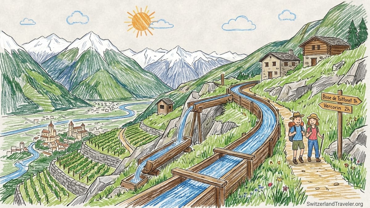
Walk a bisse in Valais and you are not just hiking a pretty path. You are following the lifelines that made farming on these dry slopes possible for centuries, where wooden troughs clung to cliffs and whole communities shared the responsibility of guiding precious meltwater across impossible terrain. Today more than 100 historic bisses still trace the hillsides of Valais, many still in water. Since December 2023, traditional irrigation, with the Valais bisses as a flagship example, has been recognised on UNESCO’s Representative List of the Intangible Cultural Heritage of Humanity, turning these trails into a cultural experience as much as a scenic one.
Understanding Valais Bisses and When They Carry Water
The word “bisse” (or “Suone” in German) refers to narrow open irrigation channels that divert water from mountain streams across dry slopes to meadows, orchards and vineyards in Valais. Many were first dug between the fourteenth and sixteenth centuries, often directly into cliff faces. Their upkeep required complex rules about water sharing, communal workdays and watchmen who would patrol the channels to repair damage and prevent disputes. Today that living know-how, from the engineering tricks to the social organisation that keeps the water flowing, is exactly what UNESCO highlighted when it added “traditional irrigation: knowledge, technique and organisation” to its Intangible Cultural Heritage list in 2023.
For travellers, the key question is whether there is still water in a given bisse. In Valais the irrigation season generally runs from roughly mid May to mid October. That is when you are most likely to see clear meltwater rushing alongside the path or sliding silently through wooden troughs. However, exact dates vary by altitude, snowpack and the needs of local farmers. A low vineyard bisse above Sion might fill in early May, while a higher channel near 1,800 metres may wait until June. Heavy rain, late snow or summer drought can also lead to short interruptions.
If seeing running water is important to you, ask at a local tourist office in places like Sion, Crans Montana, Nendaz or Anzère shortly before your hike. Staff there are usually in touch with the local consortages that manage each bisse and can tell you whether a channel is in operation that week. Even without water, the paths often make superb balcony walks with big views, but some high routes, such as the vertiginous sections of Torrent Neuf or the historic line of the Bisse du Ro, feel more atmospheric when you can hear the sound of water and imagine what it took to bring it there.
Because there are more than 100 bisses across Valais, it is neither practical nor necessary to “collect” them all. Instead, most visitors are better off picking one or two that match their comfort level, interest in history and base location. The following sections are organised by traveller type, not by geography, to help you match your appetite for exposure, family friendliness or full day effort to the right historic canal.
Best Easy Bisse: A Gentle Balcony Walk for First Timers
If you want a relaxed introduction to bisse walking, with minimal vertigo risk and straightforward logistics, look toward the gentler irrigation paths near the main Rhône valley. One of the most accessible is the Bisse de Clavau, which runs above the city of Sion through terraced vineyards on the right bank of the Rhône. The trail follows the stone walls and small irrigation channels that water some of Valais’s most famous wine parcels, but the exposure is generally moderate. While there are short sections with drops, the path is wide enough for cautious walkers and is popular with locals in trainers rather than heavy boots.
The Bisse de Clavau is also simple to reach by public transport. Travellers can use regular trains to Sion and then local buses or a short taxi ride to reach starting points like Sion, St Léonard or the small villages on the hillside. Walking times vary from around two to four hours depending on the exact route and whether you use buses to shorten the approach. Because the bisse irrigates vineyards rather than alpine pastures, it usually carries water for much of the main irrigation season, often from May into October, although exact dates shift with weather and agricultural needs.
In practical terms this is an ideal first bisse if you want to combine light exercise with tasting Valais wines and local food. Several guérites, or simple vineyard taverns, open during the warmer months and serve plates of cured meats, local cheese and glasses of Fendant or Cornalin on shaded terraces overlooking the valley. Prices for a simple plate of charcuterie with a glass of wine typically fall in the range you would expect for Swiss vineyard bars, and many accept card payments, though it is wise to carry some cash. Families with older children who are used to walking on uneven ground generally find this route manageable, but parents should still keep an eye on kids where the path narrows above terraced walls.
For an even gentler option, ask locally about short stretches of low valley bisses near where you are staying. Around Nendaz, for example, bisses such as the Bisse du Milieu and Bisse Vieux offer mostly level walking through larch and spruce forests with only brief exposed spots, and local tourism offices publish free brochures and maps showing distances and public transport connections. These are good choices on a first afternoon in Valais or for a recovery day between more demanding hikes.
Most Dramatic Cliffside Route: Torrent Neuf and Bisse du Ro
Travellers who actively seek out thrilling paths with tunnel sections, footbridges and big drops should focus on two standout cliffside bisses: the Torrent Neuf near Savièse and the Bisse du Ro above Crans Montana and the Lac de Tseuzier. Both preserve sections of historic routes that once clung to vertical rock faces, and both have been adapted as spectacular hiking trails.
On the slopes above Sion, the Torrent Neuf (also known as the Bisse de Savièse) was originally built to carry water from the river Morge around sheer cliffs to the dry Savièse plateau. The historic line is now equipped with metal walkways, suspension bridges and carved tunnels that allow modern hikers to experience the dramatic setting while remaining on a clearly marked, officially maintained trail. Several bridges hang across side ravines, and vertical drops are often hundreds of metres deep. Although safety rails protect you from the edge, this is absolutely not the right choice for visitors who suffer from vertigo or dislike feeling air under their feet.
The Bisse du Ro, reached from Crans Montana or the Tseuzier dam, offers a similar combination of history and exposure. The original bisse once carried water along wooden gutters fastened to a near vertical rock wall high above what is now the Lac de Tseuzier. Today the section of canal that was dug into the cliff has been bypassed by a 95 metre tunnel under the Mont Lachaux, but parts of the exposed historic route have been preserved as a footpath. Travel reports and local descriptions highlight very exposed balcony sections and a long drop to the valley floor. Even though there are handrails and cables, the sense of void is intense, and some hikers with a fear of heights describe turning back long before the end.
In both cases, bus and lift connections make the approach and exit practical without a car. For Torrent Neuf you can travel by bus from Sion to village stops on the Savièse plateau, then follow clear signage for two to four hours of hiking, with options to make shorter out and back walks. Around Crans Montana, lifts and local buses link the resort to trailheads near the Tseuzier dam or mid mountain stations, allowing loop or one way routes that descend gently back to the town. Before setting out, check with local tourist offices about any temporary closures due to rockfall work or maintenance, and be aware that these cliffside routes are unsuitable for small children or anyone uncomfortable with serious exposure, even in dry conditions.
Because of the altitude, snow can block access to higher parts of the Bisse du Ro or nearby paths well into May or even June after snowy winters. When conditions are dry in summer and early autumn, you will usually find the channels in water during the main irrigation period. However, even without visible water in every section, the combination of tunnels, views and the story of the people who built these lines makes these two bisses the definitive choice for travellers who want the most dramatic cliffside experience in Valais.
Best Vineyard Bisse: Walking Through the Terraces Above Sion
Although several bisses water vineyards in Valais, the slopes above Sion provide one of the best combinations of heritage, scenery and easy logistics for visitors interested in wine. The Bisse de Clavau, already mentioned as an easy introductory walk, deserves special attention as the quintessential vineyard bisse, because it threads through centuries old stone terraces that produce appellations you are likely to see on wine lists all over Switzerland.
The path follows a near level line as it contours around the hillside, with the city of Sion, its twin medieval castles and the broad Rhône valley spread out below. On clear days, snow covered peaks frame the view to the south and east, while to your immediate left and right you can watch water flowing in narrow channels between vine parcels or disappearing into small tunnels under the path. Information boards installed by local authorities explain how water is allocated and how each landowner is still entitled to certain “water hours” during the irrigation season, echoing practices that go back hundreds of years.
Reaching the Bisse de Clavau from Sion station usually involves a 10 to 20 minute walk uphill through town, or a short ride on a local bus that drops you higher on the slope. Tourist offices distribute free maps and can suggest circular routes that take in the bisse, one or two guérites and viewpoints before looping back down to the city in two to three hours. Many travellers combine the walk with a late lunch or early evening tasting, then catch a train onward along the Rhône valley. Because Sion is on the main line between Geneva, Lausanne and Brig, it works well as a stopover between regions.
If you have a car or are happy to spend a bit longer on buses, irrigation paths above villages such as Chalais and Réchy, watered by channels like the Bisse de Ricard, also offer an atmospheric mix of vineyards and heritage. The Bisse de Ricard, which takes water from the Navisence near Niouc and carries it for about seven kilometres to irrigate hundreds of hectares of vines and fields around Chippis, Chalais and Réchy, was named “Bisse of the Year 2026” by the Valais Bisses Association in recognition of extensive restoration work. Parts of its route include short cliffside sections and a tunnel before the water reaches the terraced slopes lower down, making it a good choice for travellers who want a taste of both engineering drama and vineyard scenery without committing to the full exposure of Torrent Neuf or Bisse du Ro.
Best Family Bisse Walk: Safe Paths and Short Stages
Families visiting Valais often want a walk that feels adventurous and different from a city park, but without technical sections or excessive drops. Several bisses meet those criteria, particularly in areas where the channels run through forest or meadows on broad paths. Around Nendaz, for instance, the Bisse du Milieu and Bisse Vieux are well known for their gentle gradients and shady sections, and local tourism offices publish family oriented circuits where you can push a sturdy stroller for some segments or let older children walk independently.
These mid altitude bisses, typically between 1,000 and 1,400 metres, usually start flowing a bit later in spring than the lowest vineyard bisses but are often still in water well into October if temperatures stay mild. Because they irrigate pastures and orchards, you will often pass cows, goats and small farm buildings along the way. Picnic tables and simple fire pits are common at clearings, and many families bring sausages, bread and local cheese to grill, buying what they need from village shops the day before. Free leaflets available from Nendaz or nearby resorts mark official barbecue sites where fires are permitted during normal conditions, although bans can apply in very dry summers.
Another family friendly choice is to walk sections of the Grand Bisse d’Ayent above Sion, but to avoid the historic cliffside section near Torrent Croix. The full traditional line of the bisse once followed exposed ledges where wooden troughs carried water over sheer drops. Today that most dramatic part has been taken out of use and replaced by a 95 metre tunnel, but the path is still narrow and clings to the rock in places. Local descriptions and signage note that this sector can cause vertigo, even though it is equipped with a handrail. Families with small children or anyone wary of heights can ride a bus to the “Le Samarin” stop above Ayent and begin their walk there, downstream of the main exposure. From that point the channel is in water and the trail becomes a much more relaxed forest and pasture walk suitable for most ages.
Whichever family bisse you choose, plan your day conservatively, allowing time for children to explore side paths and streams. Aim for circular routes of two to three hours of walking, with options to shorten the loop if needed using bus stops or lift stations. Make sure that every adult in the group understands that even “easy” bisse paths can still have steep drops in places. Young children should be kept close by whenever the trail narrows or approaches an edge, and in wet weather you may want to switch to a lower route, as wooden footbridges and rocks can become slippery after rain.
Most Impressive Historic Engineering: Grand Bisse d’Ayent and Tsittoret
Some travellers are primarily interested in the engineering story behind the bisses rather than in maximizing exposure or hunting for vineyard guérites. For them, the Grand Bisse d’Ayent and the Bisse de Tsittoret stand out as routes where you can clearly see how past generations solved the problem of moving water across difficult terrain with the tools they had.
The Grand Bisse d’Ayent collects water from the Lienne near what is now the Lac de Tseuzier and carries it for kilometres along the steep north facing slopes above Sion, irrigating vineyards, meadows and gardens on the communes of Ayent and Grimisuat. The most famous section, near Torrent Croix, once featured wooden gutters bolted directly into a vertical rock wall, with the path for the bisse keeper running beside them on a narrow natural ledge. When that line became too dangerous and maintenance too difficult, local communities drove a tunnel approximately 95 metres long through the rock in 1831 to secure the water supply. Walking here today, you can still see remnants of the old supports, the entrance and exit of the tunnel and hardware such as the hammer that allowed watchmen to listen for changes in the sound of the flow hidden within the rock.
Further up the Val d’Anniviers, the Bisse de Tsittoret reveals a different facet of historic engineering. It takes water from high above the valley and guides it along the mountainside to irrigate alpine pastures and slopes near the resort of Vercorin and surrounding villages. Parts of the route cross wild, almost untouched terrain, with views across the deep gorge of the Navisence and toward peaks that retain snow patches into summer. In several places you can see how the channel has been cut directly into rock or supported on small stone walls built by hand, as well as more modern interventions where pipes or concrete structures have replaced fragile original segments after flood or landslide damage.
Both of these bisses illustrate how traditional irrigation is not just about digging a ditch but about designing a whole system that balances gravity, distance, slope stability and community cooperation. Plaques and small open air exhibits along the Grand Bisse d’Ayent, and interpretive materials linked to regional projects in the Pfyn Finges Nature Park, explain how water rights are allocated, how maintenance days bring people together and how new challenges such as climate change and more frequent extreme weather events affect the channels. Hikers who take time to read these panels will come away with a richer understanding of why UNESCO and Swiss cultural authorities now promote traditional irrigation as a living heritage worth safeguarding.
From a practical standpoint, both the Grand Bisse d’Ayent and Bisse de Tsittoret are best tackled by reasonably fit walkers comfortable with several hours on uneven mountain paths. They are not technical alpine hikes, but loose stones, occasional exposure and modest altitude gains mean you should wear sturdy footwear and carry basic gear such as warm layers, rain protection and enough water and snacks. Public transport links, including buses from Sion up to Ayent and from Sierre or Chalais toward Vercorin and Val d’Anniviers, make point to point routes possible without a car if you study the timetables in advance.
Best Full Day Bisse Route: Combining Water, Views and Variety
For visitors who want to devote a whole day to a single outstanding bisse experience, there are several ways to link different canal sections and side paths into rewarding circuits. One classic full day idea is to combine the Lac de Tseuzier area with sections of the Grand Bisse d’Ayent or Bisse du Ro, using public transport and marked trails to form a long balcony hike above the Rhône valley.
A typical version might start with a morning bus ride from Sion or Sierre up toward Anzère or the Tseuzier dam, followed by a circuit along the lake shore and a climb onto one of the bisse paths. From there you contour for several hours, with views of turquoise dam water, larch forests and distant glaciers, before descending on side trails toward villages such as Ayent, Anzère or Crans Montana, where further buses return you to the valley. Depending on the exact route, you can expect roughly 12 to 18 kilometres of walking with several hundred metres of ascent and descent, which fills most of the day with time for stops.
Another strong candidate for a full day bisse hike is to base yourself near Nendaz or Veysonnaz and follow a circuit that strings together two or three mid altitude channels, for example segments of the Bisse du Milieu, Bisse Vieux and a neighbouring bisse. Local tourist offices promote signed loops where you can walk for five to seven hours almost entirely along gentle irrigation paths through forest and pasture, with frequent water access and picnic spots. This style of day is particularly appealing in high summer, when temperatures on the valley floor can be hot. At around 1,200 to 1,500 metres, these bisse routes usually feel cooler, and the presence of flowing water adds to the sense of freshness.
The recently restored Bisse de Ricard, honoured as Bisse of the Year 2026 by the Valais Bisses Association, also offers the potential for a full day outing for experienced hikers. The bisse itself runs for around seven kilometres from the Navisence under the suspension bridge at Niouc to the slopes above Chalais and Réchy, but access paths, side trails and options to continue across the hillside or descend to valley villages can easily extend the day. Because parts of the route traverse gorges, cliffs and a tunnel before reaching the more pastoral lower slopes, you need to be comfortable with intermittent exposure and to check in advance which sections are officially waymarked as hiking trails. Information from local communes and tourist offices is particularly important here because severe weather events in recent years have damaged parts of the water intake and supply, leading to repair works and occasional closures.
Whichever full day bisse route you choose, plan around the irrigation calendar if you want to see water flowing for most of your walk. In May and October it is common for only some sections or some bisses in a region to be in water, especially at higher altitudes. Tourist offices and the Valais bisse association’s publications can give you up to date information about which channels are active. Always carry enough drinking water regardless of how much you see in the bisse itself. In many cases that water is not treated, and while locals may drink from certain springs, visitors are usually advised to rely on fountains in villages or to carry their own supply.
The Takeaway
Choosing the right bisse walk in Valais is less about finding the single “best” route and more about matching your expectations, fitness and tolerance for heights to the right historic canal. With more than 100 bisses still shaping the landscape, you will never see them all in one trip, and you do not need to. Instead, decide whether you are primarily looking for a relaxed vineyard stroll, a family friendly forest path, a vertigo inducing cliffside adventure or a full day immersion in irrigation history.
If this is your first visit and you are based in the central Rhône valley, a day on the Bisse de Clavau or on one of the Nendaz forest bisses is an easy, rewarding way to understand why these channels mean so much to local communities. Travellers seeking drama should consider Torrent Neuf or Bisse du Ro, but only if everyone in the party is fully comfortable with exposure. For those fascinated by engineering and heritage, allocating a day to the Grand Bisse d’Ayent or Bisse de Tsittoret will reveal how much thought and labour went into every metre of canal long before modern machinery existed.
Whatever your choice, remember that you are walking inside a living system, not just on a recreational trail. Respect closures and warning signs, step carefully around maintenance works, and avoid throwing anything into the channel. By doing so, you help ensure that the delicate balance of water sharing, communal labour and heritage recognition that brought the bisses onto UNESCO’s Intangible Cultural Heritage list continues to function for the farmers, winemakers and families who still depend on it today.
FAQ
Q1. When is the best time of year to hike Valais bisses if I want to see water flowing?
The main irrigation season in Valais usually runs from roughly mid May to mid October, but exact dates vary by altitude, snowpack and local farming needs. Lower vineyard bisses above the Rhône valley often fill earlier in spring, while higher channels near 1,800 metres may only come into water in June. Local tourist offices can usually confirm current conditions for specific bisses shortly before your hike.
Q2. Which bisse is the best choice if I have a fear of heights?
If you are sensitive to exposure, avoid cliffside routes such as Torrent Neuf and the historic line of the Bisse du Ro. Instead, choose gentler paths like the Bisse de Clavau above Sion or mid altitude forest bisses around Nendaz, for example the Bisse du Milieu and Bisse Vieux. These still have occasional drops but generally follow wider, less exposed paths suitable for cautious walkers.
Q3. Are bisse hikes suitable for small children?
Some bisse walks are excellent for families, but suitability depends on the specific route. Gentle forest and meadow bisses with wide paths, such as parts of the Nendaz channels or the lower sections of the Grand Bisse d’Ayent starting from the “Le Samarin” bus stop, can work well for school age children used to walking. Narrow cliffside sections, including parts of Torrent Neuf, Bisse du Ro and the older exposed line of the Grand Bisse d’Ayent, are not appropriate for toddlers or children who might run ahead near an edge.
Q4. How do I reach the main bisse trailheads by public transport?
Most well known bisses are accessible using a combination of main line trains along the Rhône valley and regional buses up to terrace villages or resorts. For example, you can take a train to Sion then a local bus up to Savièse for Torrent Neuf, or ride to Sierre and connect by bus to Crans Montana for the Bisse du Ro. Tourist offices and regional transport websites publish current bus timetables and suggest starting points that minimise road walking.
Q5. Do I need special equipment to hike the bisses?
You do not need technical climbing gear for official bisse hiking trails, but you should wear sturdy footwear with good grip and bring standard day hiking essentials. That includes weather appropriate clothing, rain protection, sun hat, sunscreen, enough drinking water and some food. On cliffside routes a small headlamp can be useful for short tunnels, and trekking poles help some walkers with balance on uneven ground or during descents.
Q6. Is the water in the bisses safe to drink?
The water flowing in the bisses is typically untreated and may pass through agricultural areas, pastures and older infrastructure before reaching you. Locals sometimes drink from specific springs or fountains that they know well, but visitors are generally advised to treat water or rely on village fountains marked as potable and on water they carry themselves. Do not assume that just because a channel looks clear it is safe to drink from directly.
Q7. What happens on the trails outside the main irrigation season?
Outside roughly mid May to mid October, many bisses are dry or carry only a small maintenance flow, but the paths usually remain open for hiking whenever snow conditions allow. In winter and early spring, snow and ice can cover exposed sections, making narrow ledges or wooden bridges hazardous. Higher channels near dams or alpine pastures may be completely snowbound until late spring. Always check local conditions and avalanche advisories before attempting off season hikes.
Q8. Why were Valais bisses included in UNESCO’s Intangible Cultural Heritage list?
In December 2023, UNESCO inscribed “traditional irrigation: knowledge, technique and organisation” on its Representative List of the Intangible Cultural Heritage of Humanity. The Valais bisses are one of the flagship examples cited in this nomination, because they showcase centuries of communal water management, specialised maintenance skills and social rules that govern water sharing in a dry alpine environment. Walking a bisse lets you see that living heritage in action, not just the physical channels.
Q9. Can I walk the Bisse de Ricard now that it has been named Bisse of the Year 2026?
The Bisse de Ricard runs for about seven kilometres from the Navisence near Niouc to irrigate vineyards and fields around Chippis, Chalais and Réchy. After damage from floods and heavy weather in recent years, extensive restoration has been carried out, and the Valais Bisses Association awarded it the title of Bisse of the Year 2026. Some sections are suitable for hiking and offer a mix of gorge scenery, tunnel and vineyard slopes, but you should check with local tourist offices or communes for up to date information on which parts are currently waymarked and accessible.
Q10. How many bisses should I plan to hike on a one week stay in Valais?
For most travellers, focusing on one or two bisse hikes during a week in Valais is enough to gain a deep appreciation of this irrigation culture without turning your trip into a checklist exercise. You might pair a gentle vineyard bisse such as Clavau with a more dramatic or historically focused route like the Grand Bisse d’Ayent or Torrent Neuf. Additional days can then be devoted to other activities such as high alpine hikes, visiting mountain villages or tasting local wines and cheeses, all of which help place the bisses in their broader cultural context.