


The Züri Oberland Höhenweg is one of Canton Zurich’s most rewarding long-distance hikes, a 76 kilometer pre-Alpine traverse that links Winterthur with lakeside Rapperswil in four well-marked stages. Rather than a grab bag of “best hikes near Zurich,” this is a coherent journey along forested ridges, past farm inns and small villages, with regular train and bus connections that make it as suitable for day hikers as for trekkers who want to walk the whole route in one push.
What Makes the Züri Oberland Höhenweg Special
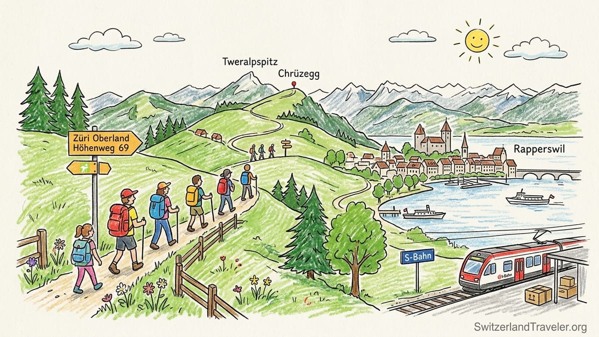
Zurich Tourism describes the Züri Oberland Höhenweg as a 76 kilometer route broken into four official stages between Winterthur and Rapperswil, threading through some of the canton’s most characteristic pre-Alpine scenery. You move from a historic industrial city into rolling pastureland, climb over panoramic ridges like Tweralpspitz and Chrüzegg, and finally descend to the medieval lakefront town of Rapperswil. The trail is part of the national Wanderland Schweiz system, signed as regional route 69, and benefits from Switzerland’s excellent trail maintenance and waymarking.
This is firmly pre-Alpine hiking rather than high-Alpine mountaineering. The highest point, near Tweralpspitz, sits at roughly 1,330 meters above sea level, and the overall route gains and loses in the region of 2,900 meters in elevation over its length. That is enough ascent to feel like a proper long-distance trek, but you never contend with glaciers, via ferrata ladders or exposed scrambling. For many visitors based in Zurich, it offers multi-day mountain scenery without the technical demands or costs of classic Alpine regions like Zermatt or Grindelwald.
Another advantage is access. Both endpoints, Winterthur and Rapperswil, are on the Zurich S-Bahn network, with direct S-Bahn services between them and frequent connections via Zurich Hauptbahnhof. For example, the S7 line runs half-hourly between Winterthur and Rapperswil, so it is easy to step off the train at either end and begin or end a stage without needing a car or private transfer. Regional buses and PostAuto services reach intermediate points like Hulftegg, adding more flexibility.
Because of this infrastructure, the Züri Oberland Höhenweg works equally well as a continuous four-day trek with simple inn or guesthouse stays, or as a menu of accessible day hikes out of Zurich, Winterthur or Rapperswil. You can commit to walking the entire 76 kilometers, cherry-pick the sections with the strongest panoramas, or create one and two day mini-treks that fit a shorter city break.
Stage 1: Winterthur to the Gyrenbad Area
The official first stage leaves directly from Winterthur, a compact city that functions as a transport hub for northeastern Switzerland. From the main railway station you are quickly on signposted city paths leading toward the wooded ridge of Eschenberg. This beginning is unusual for a long-distance route because it integrates urban green spaces, small ravines and the local wildlife park at Bruderhaus before committing to rural terrain. Many hikers spend the previous night in Winterthur, where mid-range hotels in the center often quote double rooms in the region of 150 to 220 Swiss francs, or in one of several budget options near the station.
From Eschenberg the trail winds through mixed forest and across fields to reach villages like Kollbrunn and Turbenthal, gradually climbing into the Tösstal region. The official mapping for Stage 1 lists a moderate distance of roughly 18 to 20 kilometers, depending on the exact start and finish points you choose, with cumulative ascent and descent in the 600 to 800 meter range. For fit hikers used to day walks of 5 to 6 hours, this is very manageable, but first-time visitors should factor in time for wayfinding out of the city and possibly a coffee break in Turbenthal or one of the smaller hamlets.
Many online descriptions describe this stage continuing to the historic spa hamlet of Gyrenbad above Turbenthal. Gyrenbad makes an attractive endpoint because it has traditional guesthouses in renovated farm buildings and quiet surroundings. That said, accommodation is limited, so booking ahead is advisable in high summer or on autumn weekends. If beds are not available, it is relatively simple to drop back down into the Tösstal and take a regional train from Turbenthal or a bus from nearby villages back to Winterthur for the night, then return the next morning.
Trail conditions on this stage vary from compact forest tracks to farm lanes and gravel paths. After rain, the wooded sections around Eschenberg and above Turbenthal can become muddy and slippery, especially under beech leaves in autumn. Mid-ankle hiking boots or sturdy trail shoes with good tread are a sensible choice. Springs and fountains are regular in the villages, but there are fewer water points on the forested sections, so starting with at least 1.5 liters of water per person is recommended, especially during warm spells.
Stage 2: Gyrenbad to Hulftegg Pass
The second stage leaves the Tösstal hills behind and moves onto the crest-like ridges that define the Zürcher Oberland. Descriptions from Swiss tourism and hiking platforms outline this stage as passing via landmarks such as the Schauenberg viewpoint, Huggenberg and Seelmatten, gradually working its way east to the Hulftegg pass at around 953 meters. Distances reported by hikers fall in the 17 to 20 kilometer range, with a full day’s ascent and descent in the order of 800 to 1,000 meters. Expect a solid six to seven hours of walking if you include breaks for views and meals.
Hulftegg itself is an important low pass that links the Tösstal with the Toggenburg region. There is a restaurant on the pass that serves as both a bus stop and a staging point for several hiking routes, including portions of the Toggenburger Höhenweg. The presence of an inn at Hulftegg makes this a logical overnight for long-distance hikers who want a bed and hot meal without having to leave the ridge. Prices for simple double rooms in rural guesthouses in this part of Switzerland often sit somewhere between 70 and 120 francs per person including breakfast, but availability and seasonal demand can affect this, so check directly with the property when planning.
Public transport at this stage endpoint adds flexibility. PostAuto buses serve the Hulftegg pass, connecting down to Steg im Tösstal in the canton of Zurich and to Mühlrüti in the Toggenburg area. From Steg, you can connect back to Winterthur or Zurich via the S26 train line that runs through the valley, while from the Toggenburg side you can eventually connect toward Wil or Wattwil. This web of connections is useful if you encounter bad weather and decide to exit the route early, or if you choose to hike only the panoramic portion of Stage 2 as a day trip.
Stage 2 is where the character of the Züri Oberland Höhenweg really feels like a “height path” rather than a valley trail. Long segments follow broad ridges and meadows, with views into the Thurgau lowlands to the north and toward the more mountainous Toggenburg to the south. On clear days you may glimpse distant peaks of the eastern Alps. The terrain, however, remains non-technical, with standard Swiss yellow hiking signs and red-and-white paint blazes marking the path at intervals. Mud can again be an issue after storms, particularly on pasture crossings where cattle churn up the ground, so gaiters can be useful if conditions are wet.
Stage 3: Hulftegg to Chrüzegg and the Pre-Alpine Crest
The third stage runs along what many hikers consider the heart of the Züri Oberland Höhenweg. Leaving Hulftegg, the route climbs to Tweralpspitz and continues over or near a chain of summits and shoulders, eventually reaching the mountain inn at Chrüzegg. With Tweralpspitz reaching around 1,330 meters, this is the highest section of the entire route and offers sustained Alpine-style panoramas despite still being in pre-Alpine hills. Looking south and east, ranges in the cantons of St. Gallen and Glarus often appear, while to the north you can see back over the green ridges toward Zurich’s lowlands and lakes.
This stage typically covers roughly 15 to 18 kilometers, with cumulative elevation gains and losses again in the vicinity of 800 to 1,000 meters. The path frequently undulates along the ridge rather than climbing one big pass and descending on the far side, which can be deceptively tiring. Hikers who are comfortable with 6 to 7 hour days and steady ups and downs will find it rewarding, but newcomers should pace themselves and budget time for lunch at one of the mountain inns. In fine weather, it is entirely possible to buy a hot meal and drinks at Hulftegg before starting, then stop again for refreshments at Chrüzegg without needing to carry excessive food.
Chrüzegg is a key logistical point because it has a well-known mountain inn that offers simple rooms and dormitory-style accommodation. These family-run places often charge in the region of 50 to 90 francs per person for half-board (dinner, bed and breakfast), which can be good value considering the remote location. However, capacity is limited. On sunny summer weekends or in the height of the autumn foliage season, it is not unusual for Swiss families and hiking clubs to book many of the rooms. Reservations are strongly recommended if you plan to stay here as part of a multi-day trek rather than dropping down to a valley guesthouse.
In terms of transport, Chrüzegg itself does not have direct rail service, but paths lead down from the ridge to several villages with bus connections. To the north, trails descend toward regions like Wattwil or the valley around Fischenthal, while to the south and west paths connect with stations and bus stops that link to the S-Bahn network in Rapperswil or Wattwil. Many hikers use these descents to turn Stage 3 into a standalone day trip, taking a bus up to Hulftegg in the morning, walking the ridge via Tweralpspitz and Chrüzegg, then descending to catch an afternoon train back to Zurich.
Stage 4: Chrüzegg to Rapperswil on Lake Zurich
The final stage feels very different again, transitioning from grassy crest to the shores of Lake Zurich. Starting from Chrüzegg, the route continues over gentle high pastures and wooded ridges before beginning a steady descent via farm roads and forest paths toward Rapperswil. Along the way, you occasionally glimpse the blue of Obersee, the upper basin of Lake Zurich, and pass through small hamlets that offer snack stops or farm shops where you can buy cheese, cured meats or seasonal fruit. Distances recorded for this leg typically range from 18 to just over 20 kilometers, with a net loss of elevation from around 1,200 meters at Chrüzegg to about 408 meters at the lake.
Cumulative descent on this day can exceed 1,000 meters, which can be tough on knees and ankles, particularly on gravel service roads. Trekking poles are very helpful here. Because the terrain is non-technical, fit and experienced day hikers often choose this as a long day walk on its own, taking public transport to a trailhead near Chrüzegg in the morning and finishing in Rapperswil in time for an early dinner on the lakeside. Rapperswil has a wide range of accommodation, from simple guesthouses to four-star hotels, and its old town and castle are attractions in their own right.
Rapperswil’s key advantage is its position in the public transport network. The town is served by several S-Bahn lines, including a half-hourly service that runs directly to Winterthur via Zurich, which allows you to return to your starting point or onward destination without any difficulty. There are also frequent boats operated on Lake Zurich between Rapperswil and Zurich Burkliplatz, particularly from spring through autumn, which some hikers use as a scenic way to close the loop after completing the route. Local buses around Rapperswil-Jona connect the railway station with residential districts and lakeshore promenades.
Food and water are less of a concern on this final stage than on some earlier ones because you are gradually re-entering more densely settled areas. Nevertheless, it is still smart to fill water bottles at public fountains in villages and to carry snacks, especially if you intend to picnic at one of the viewpoints. In high summer it can be hot lower down, and some stretches of the descent have limited shade, so sun protection is important even though you are no longer in the high mountains.
Continuous Trek, Day Hikes and Luggage Options
The Züri Oberland Höhenweg is flexible enough to suit several styles of travel. Walking it as a continuous four-stage trek gives a satisfying sense of journey from one urban center to another, and many hikers structure their days as Winterthur to the Gyrenbad area, Gyrenbad to Hulftegg, Hulftegg to Chrüzegg, and Chrüzegg to Rapperswil. This fits a long weekend plus a travel day on either side. If you like to travel light, this format works well with a 30 to 40 liter backpack that carries a change of clothes, rain gear and basic toiletries, as you can sleep in guesthouses and mountain inns each night rather than carrying camping equipment.
Luggage transfer services specific to this exact route are not as widely advertised as on famous national trekking classics, but some Swiss-wide baggage services allow hotel-to-hotel transfers between larger centers such as Winterthur and Rapperswil. In practice, many hikers solve the luggage question by basing themselves in Zurich or Winterthur and treating parts of the route as day hikes, or by carrying all they need for four days in a single pack. Because the route repeatedly passes within reach of S-Bahn lines and PostAuto routes, it is possible to exit and rejoin using public transport instead of relying on a support vehicle.
As individual day hikes, the most popular sections tend to be the ridge from Hulftegg to Chrüzegg with its broad panoramas, and the descent from Chrüzegg to Rapperswil that combines hill scenery with a rewarding lakeside finish. For example, a visitor staying in Zurich could take an early train and bus via Winterthur to Hulftegg, hike the ridge in five to six hours, descend to a valley station, and be back in the city for dinner. Another day might focus on the Eschenberg and Tösstal section of Stage 1, with the option to shorten the walk at several intermediate train stations.
For those specifically looking for luggage-free walking, one practical compromise is to book two nights in a convenient base like Rapperswil or Winterthur and design out-and-back or point-to-point day hikes that always end where you have left most of your bags. Because Zurich’s regional trains are frequent and reliably timed, even a somewhat convoluted sequence of S-Bahn and bus connections is still straightforward to manage, and station staff can provide up-to-date timetables and platform information in English.
Seasonal Conditions, Mud and Safety
The pre-Alpine nature of the Züri Oberland Höhenweg means that it is usually accessible for hiking from late April or early May through late October, depending on the year’s snow and rain patterns. Lower sections near Winterthur and Rapperswil are walkable even earlier, but the ridges around Hulftegg, Tweralpspitz and Chrüzegg can hold patches of snow into April. In high summer, from late June through August, all four stages are usually snow free, and many Swiss families treat them as weekend hikes.
Spring and autumn, however, bring two challenges: mud and variable weather. The route spends long stretches on forest tracks and cross-pasture paths that soften quickly after rain. Steep earth paths through beech woods, particularly on north-facing slopes, can stay greasy for days. Visitors used to drier mountain paths may find it surprisingly slippery in places. Carrying lightweight hiking poles makes descents more secure, and wearing footwear with solid grip is more important here than in dry Mediterranean hiking regions.
Weather can change fast, even though you are not in the high Alps. A morning that begins with low cloud and drizzle over Winterthur can clear by midday to reveal distant summits from Schauenberg or Chrüzegg, but the reverse can also happen, with thunderstorms building on humid summer afternoons. Swiss weather services provide detailed regional forecasts, and it is worth checking the Tösstal and Rapperswil regions separately when planning your stages. In case of storms, you can often use public transport to skip a particularly exposed ridge section and rejoin the following day.
From a safety perspective, the route is suitable for anyone comfortable with all-day hiking on uneven terrain. There are no glaciers, ladders or exposed ridges that require mountaineering skills. Families with older children often tackle individual stages, especially where there are farm inns selling ice cream or playgrounds near viewpoints. Standard mountain precautions still apply: pack a waterproof jacket, an insulating layer, a basic first-aid kit and enough food and water. Mobile phone coverage is generally good along the route, but can drop in small forested hollows or side valleys.
Food, Water, Accommodation and Trail Signage
One of the pleasures of the Züri Oberland Höhenweg is how often you can combine hiking with simple local food. Mountain inns and farm taverns serve plates of rösti, bratwurst, cold cuts and cheese, often with ingredients from the surrounding pastures. Places like Hulftegg and Chrüzegg are well known excursion destinations for locals, so they typically operate throughout the main hiking season from spring to autumn, although exact opening days can vary outside school holidays. Carrying a packed lunch is still wise, especially on shoulders of the season or weekdays when some establishments might close.
Public water fountains are a common feature in Swiss villages and hamlets, and many of these provide potable water unless indicated otherwise. On the ridges themselves, dedicated water points are less frequent, so plan refills in settlement clusters or ask at inns along the way. In summer, carrying at least 1.5 to 2 liters per person for each stage is prudent, with more on very hot days. Electrolyte tablets can be a good addition for visitors not used to sustained exertion.
Accommodation along the route consists mainly of small guesthouses, farm stays and mountain inns, rather than large hotels. Near Winterthur and Rapperswil, you have a full spectrum of city lodging, including hostels and business hotels. In the middle stages, however, beds are limited and reservations make sense, particularly if you rely on specific properties like the Hulftegg inn or the refuge at Chrüzegg. Pricing across the region reflects general Swiss levels: simple double rooms with breakfast often fall roughly between 70 and 120 francs per person in rural settings, while half-board in mountain inns may cost in the region of 50 to 90 francs per person. Exact figures change with season and room type, so verify when booking.
Trail signage follows the standard Swiss system. The Züri Oberland Höhenweg is marked with yellow signposts at junctions, often carrying the trail’s name and the number 69, and with red-and-white paint blazes on trees and rocks along the way. Time estimates on the signs are given in hours and minutes and are calculated for an average hiker without breaks. Foreign visitors sometimes underestimate how accurate these timings are. If a sign indicates 2 hours 30 minutes to Hulftegg, most regular walkers find that they arrive within a similar window unless they stop frequently. Carrying a paper hiking map or an offline-capable app is still a good backup in fog or snow, when visibility of markings can be reduced.
Best Panoramas, 1-Day Sampler and 2-Day Shortened Version
All four stages have their own appeal, but the strongest Alpine panoramas are generally found on the high ridges between Hulftegg, Tweralpspitz and Chrüzegg. Here the horizon opens, and in clear conditions you can see chains of higher peaks in several directions while still standing on grassy pre-Alpine hills. The contrast between close foreground pastures, distant rockier mountains, and the occasional glimpse of lakes below makes this section especially photogenic.
For a one-day sampler that captures the essence of the Züri Oberland Höhenweg, a practical choice is to hike from Hulftegg to Chrüzegg. You can reach Hulftegg by combining an S-Bahn train from Zurich or Winterthur with a PostAuto bus, then follow the signed Höhenweg via Tweralpspitz to Chrüzegg in roughly five to six hours. After a meal at the mountain inn, descend on marked trails to a valley village with a bus stop that connects to the rail network and return to Zurich or Rapperswil in the evening. This day introduces you to the route’s ridge walking, farm landscapes and inn culture without requiring four days of vacation.
For a two-day shortened version, one appealing option is to walk from Hulftegg to Chrüzegg on day one, stay overnight at Chrüzegg, and then continue on day two down to Rapperswil. This creates a compact mini-trek of roughly 35 to 40 kilometers in total, including significant but manageable elevation changes, and has the satisfying endpoint of arriving in a lakeside town with restaurants and hotels. You can leave an overnight bag in Rapperswil, travel light over the hills, and then return to your base at trip’s end using the direct S-Bahn link between Rapperswil and Winterthur or Zurich.
Another two-day variant, suitable if you are more interested in rural valleys and forested hillsides than lake scenery, is to combine the latter half of Stage 1 with Stage 2. For example, you might start in Turbenthal, hike through the Gyrenbad area to Schauenberg and onward along the ridge, then overnight in a small guesthouse before finishing at Hulftegg the following day. From Hulftegg you can descend to Steg im Tösstal and ride back to Zurich or Winterthur. This focuses your time on the wilder central sections and leaves the urban segments at either end for separate day trips.
The Takeaway
The Züri Oberland Höhenweg is one of the most coherent long-distance products within easy reach of Zurich, offering a full 76 kilometer journey through pre-Alpine landscapes without the technical challenges of high-Alpine trekking. It connects a historic industrial city with a medieval lake town, crosses ridges with genuine mountain panoramas, and remains within the reach of trains and buses at multiple points along the way. For visitors based in Zurich, it represents an opportunity to experience multi-day hiking that feels remote on the ground yet is logistically straightforward.
Because the elevations are modest and the infrastructure strong, the route suits a wide range of hikers, from locals looking for a series of weekend day hikes to international travelers planning a four-day trek with nights in guesthouses and mountain inns. Muddy forest sections, occasional steep descents and changeable weather mean it should not be underestimated, but it does not require specialized equipment beyond what most hikers already own. Thoughtful planning around stages, accommodation and public transport can turn it into a highlight of a Swiss trip, whether as a 1-day sampler of the Hulftegg to Chrüzegg ridge or a full traversal from Winterthur to Rapperswil.
In a country famous for blockbuster Alpine icons, the Züri Oberland Höhenweg stands out by being quietly accessible. It delivers long-distance scenery, working landscapes and everyday rural life, proving that you do not have to go to the highest peaks to find rewarding multi-day hiking in Switzerland.
FAQ
Q1. How long is the Züri Oberland Höhenweg and how many days do I need?
The official route is about 76 kilometers from Winterthur to Rapperswil, divided into four stages. Most hikers allow four walking days, either as a continuous trek or separate day hikes.
Q2. What level of fitness and experience do I need for this trail?
You should be comfortable walking 15 to 20 kilometers a day with several hundred meters of ascent and descent, on uneven paths. No mountaineering skills are required, but basic hill-walking experience helps.
Q3. When is the best season to hike the Züri Oberland Höhenweg?
The main season runs roughly from late April or early May through late October. Summer offers the most reliable snow-free conditions, while autumn brings colorful forests but potentially more mud and variable weather.
Q4. Can I hike the trail in sections as day trips from Zurich?
Yes. Thanks to frequent S-Bahn trains and PostAuto buses, you can easily treat each stage as a standalone day hike, especially the panoramic ridge section between Hulftegg, Tweralpspitz and Chrüzegg and the descent toward Rapperswil.
Q5. Are there luggage transfer services along the route?
Dedicated luggage transfer tailored specifically to this trail is not widely publicized, but some Swiss baggage services can move bags between large centers like Winterthur and Rapperswil. Many hikers simply carry a light pack or base themselves in a nearby city.
Q6. What kind of accommodation will I find on the trail?
Expect small guesthouses, farm stays and mountain inns along the route, with a wider choice of hotels in Winterthur and Rapperswil. Rural rooms with breakfast usually cost somewhere in the range of a modest Swiss hotel, and advance booking is wise on busy weekends.
Q7. Is the trail well marked and easy to follow?
Yes. The route is part of Switzerland’s official hiking network and is signposted with yellow direction boards, often carrying the trail’s name and number 69, plus red-and-white paint blazes. Carrying a map or offline app remains a good backup.
Q8. Which stage has the best Alpine views?
Most hikers consider the ridge between Hulftegg, Tweralpspitz and Chrüzegg to have the strongest Alpine panorama, with wide views toward higher ranges while still walking on grassy pre-Alpine hills.
Q9. Are food and water easy to find along the way?
Villages and hamlets offer public fountains, and there are several inns and farm restaurants along the ridges, particularly around Hulftegg and Chrüzegg. You should still carry sufficient water and snacks, especially outside peak season.
Q10. Can families with children hike parts of the Züri Oberland Höhenweg?
Yes, families with reasonably active children often hike shorter sections, such as a half-day walk near Eschenberg above Winterthur or a ridge segment near Chrüzegg. Choosing modest distances and having bailout options via bus or train makes it more enjoyable.