


By mid-September the larches above the Goms valley were just starting to yellow when I pointed a rental hatchback out of Oberwald and onto the Furka Pass road. I had come to drive this piece of tarmac specifically from the Valais side, from the quiet pastures of the upper Rhône toward the hairpins, the Rhône Glacier and the storied Belvédère bend. What follows is not a theoretical guide but a report from that actual drive: one mid-sized petrol Volkswagen Golf, one cool late-summer afternoon, one driver with plenty of mountain miles but a healthy respect for narrow Swiss roads and big yellow PostBuses.
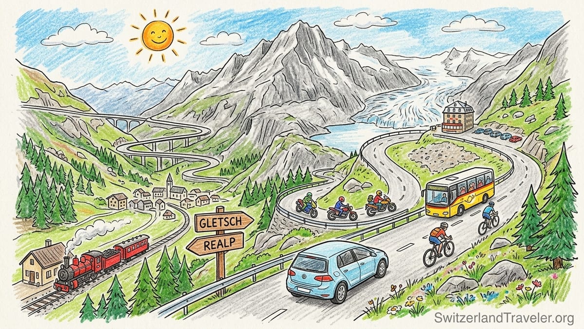
Setting off from Oberwald in a Real-World Car
I drove the Furka from west to east, starting in Oberwald in the canton of Valais and finishing in Realp in Uri. The car was a current-generation Volkswagen Golf with a 1.5‑litre petrol engine and automatic gearbox, a typical compact rental you might collect in Geneva or Zurich. I had two adults on board, light luggage and standard road tyres, no chains. The date was a clear weekday in mid-September 2025, around 15:00 when I left Oberwald, with the air in the village a cool 13 degrees Celsius.
From the first junction beyond Oberwald it is obvious that this is a proper mountain pass, not an overgrown country lane. The carriageway is paved to Swiss standards and broadly wide enough for two cars, with a centre line on most sections and regular place-name signs pointing to Gletsch and Realp. The first few kilometres shadow the young Rhône through forest and meadow, with only gentle curves and good visibility. In a car like the Golf the road feels easy here, more like a scenic detour than the high pass it will soon become.
Traffic on departure from Oberwald was light. I met a handful of local cars, a couple of campervans and one postal bus heading down-valley. There were no trucks; heavy vehicles generally avoid the Furka in favour of the car shuttle through the Furka Base Tunnel between Oberwald and Realp, which runs all year and removes the need to wrestle larger vehicles over the 2,429‑metre pass. That absence of lorries already made the drive feel less stressful than, say, crossing some Italian passes where coaches seem to appear on every blind bend.
Even on this lower stretch the weather hinted at what was to come higher up. Patches of sun alternated with cloud shadows moving fast across the valley sides, and as soon as the road began to lift away from the river I could feel the temperature dropping a couple of degrees, shown on the car’s display and in the way we instinctively reached for light jackets when stepping out.
Climbing from Goms to Gletsch: First Taste of Exposure
The character of the drive changes decisively after the small settlement of Oberwald is in the rear-view mirror and the road starts to climb in earnest toward Gletsch. This is still the Goms valley, but the forest thins, the slopes steepen, and the sense of being on a through-route between cantons replaces the feeling of pottering along a valley road. Long, sweeping curves give way to more compressed bends that begin to stack as the gradient increases.
On my drive the tarmac was bone-dry, with no standing water or gravel piles, and there were no roadworks. Surface quality felt excellent: no potholes and only the occasional transverse ridge from frost action. That said, the edges are not as forgiving as a motorway. There are places where the white edge line sits just a metre or two from a guardrail and a substantial drop beyond. In these sections the Golf felt modestly sized and entirely appropriate. In a wider SUV, especially something like a Volkswagen Touareg or BMW X5, you would be conscious of your width, particularly when passing a campervan or coach.
Gletsch appears suddenly in a small bowl ahead, a pocket hamlet of hotels and railway buildings squeezed between the roads for the Furka and Grimsel passes. As you drop the last short descent to reach it, you get your first partial glimpse of the Rhône Glacier high to the east. It is not yet dramatic, more a patch of dirty white tucked into the upper valley, but you can already sense why this crossing became a magnet for tourists once the first road opened across the pass in the 1860s and later when the Furka Oberalp Railway brought visitors directly to Gletsch.
In Gletsch itself I stopped in a small roadside parking area near the cluster of buildings and the historic steam railway station. The spaces were free the day I passed, with no barrier system and no time limit stated on local signage, although that can change by season. A restored Furka steam train stood at the platform, part of the heritage line that now operates in summer over the old summit route between Realp and Oberwald. Seeing the carriages waiting there sharpened the choice every traveler faces in this valley: to continue by road, take the leisurely train above the valley, or simply linger in Gletsch and absorb the history and scenery from a lower vantage point.
Into the Hairpins Above Gletsch: Beauty and Intimidation
Leaving Gletsch in the direction of Realp, the Furka road rears up immediately on the slope behind the hamlet. From here the hairpins begin in earnest. On the Valais side the sequence above Gletsch climbs in tiers, each level stacked above the previous one, so that if you glance into the mirrors you see not only the village shrinking below but often two or three earlier turns you have already taken.
In the Golf the first few hairpins felt technical but never unmanageable. Visibility is mostly good, with open sightlines through each bend, and the road is wide enough here that a normal car and a postal bus can pass without anyone needing to scrape a barrier. The intimidating part has less to do with absolute width and more with mental exposure. You can see just how high you are climbing, the drops are real, and some guardrails have obvious scuffs where others have misjudged distances. If you are unused to mountain driving, your hands might tighten a little on the wheel.
On my ascent the traffic mix added a layer of complexity. Several groups of motorcyclists were riding the pass in both directions, often in loose formations of three or four bikes. Most kept their lines tidy and their speeds moderate, but one or two approached bends quite briskly, leaning deep across the centre line. At the same time I came up behind a small convoy of road cyclists, clearly part of an organised tour, grinding steadily uphill. Passing them safely required patience: you wait for a straight or a section of improved visibility between bends, indicate, and then commit, checking both for descending traffic and for any motorcycles swinging wide.
There were also two yellow PostBuses to deal with, both heading downhill. These scheduled buses have priority on tight bends, and local signage reminds drivers to give way where the road narrows. On one particularly constrained turn the bus used most of the available width, and I brought the Golf to a complete halt by the guardrail so it could swing through. In that moment the road did feel genuinely intimidating. The drop beyond the guardrail was obvious, there were no extra run-off strips, and the bus filled the windscreen. Still, because speeds were low and both drivers were alert, it never crossed into being dangerous, only impressively tight.
Approaching the Rhône Glacier and Belvédère Bend
About two-thirds of the way from Gletsch to the pass summit, after the main staircase of hairpins, the landscape opens briefly and the famous Belvédère area comes into view. The road here straightens for a moment before curling around the abandoned Hotel Belvédère, a stone building perched exactly in a tight bend with the Rhône Glacier basin opposite. This is the scene that has filled guidebooks and car adverts for decades, and it is every bit as striking in person, though the glacier today sits noticeably higher and further back than in historic photographs.
I pulled into the parking area on the glacier side of the road, opposite the hotel. In 2025 there was a gravel and asphalt lot with space for a few dozen vehicles, including several campervans and a couple of tour buses. Parking for private cars operated on a pay-and-display system during daytime hours, with machines that accepted Swiss francs and card. Rates change periodically, so you should check the current tariff when you arrive rather than rely on printed guidebooks. Visibility for rejoining the road afterward was good, though when coaches are present you may need to edge forward carefully to see past them.
From the car park a short, gently descending path leads toward the current viewpoint over the glacier and the small proglacial lake that now occupies part of the former ice tongue. In previous years an artificial ice grotto was cut into the glacier each season, with a separate entrance fee and seasonal opening hours advertised locally. Operations continue to adapt as the glacier recedes, and when I visited there was still signage for glacier access but with caution notices about changing conditions and the potential for temporary closures due to safety or weather.
Standing by the barrier above the lake, I could trace the glacier’s path back into the high cirque. The ice surface carried bands of darker debris and looked more rugged than smooth. The silence was only broken by motorcycle exhausts echoing off the cliffs when a group accelerated away from the Belvédère bend toward the summit. From this vantage point the scale of the road is obvious. You can watch vehicles trace tiny arcs along the hairpins far below, then track them as they crawl toward you and on to the pass. It drives home how concentrated you need to be behind the wheel, especially when the scenery is constantly pulling your gaze away.
Weather, Altitude and Seasonal Uncertainty
The day I drove, the most noticeable change with altitude was temperature and wind. When I stepped out at the Belvédère parking area, roughly 2,270 metres above sea level, the car’s thermometer showed 7 degrees Celsius, a full six degrees cooler than Oberwald less than an hour earlier. A stiff crosswind blew up the valley, strong enough to tug at car doors and make standing near exposed edges feel more serious. The sky, which had been patchy blue in the Goms valley, was now built of quick-moving cumulus clouds, and light conditions shifted minute by minute.
At the actual Furka Pass summit, signposted at 2,429 metres, the weather sharpened further. Patches of old snow lingered in hollows on the north-facing slopes even in mid-September, and the air had that raw, thin quality you only find above 2,400 metres. Visibility remained good on my crossing, but it was easy to imagine how fast conditions could deteriorate with a sudden fog bank or early snow flurry. There are no tunnels here to retreat into, only open road exposed to wind and weather.
This exposure is the reason the Furka closes each winter. Exact opening and closing dates vary every year depending on snowfall and avalanche control work. In a typical recent season the road has opened sometime in June and closed again by late October or earlier if snow arrives with force. Local touring companies that include the pass in their itineraries confirm bookings only once the road status is published by the Swiss authorities, because late snow clearance or an early storm can shift the usable window significantly.
For drivers arriving from further afield, the safest habit is to check a live pass-status source on the day of travel, rather than rely on an old article or a fixed calendar date. Auto clubs in Switzerland maintain online pass portals that list whether the Furka is open, restricted or fully closed, sometimes including notes about temporary daytime closures for construction. If the pass is closed, the alternative is to place your vehicle on the car shuttle through the Furka Base Tunnel between Oberwald and Realp, which runs throughout the year except for planned maintenance periods.
Concentration, Traffic and the Mental Load of the Drive
Driving the Furka from Valais demands more sustained concentration than most visitors might expect from looking at postcard pictures. Between Oberwald and the summit the majority of corners offer good visibility, and the road is generally wide enough for two oncoming cars to pass without drama, yet the combined effect of hairpins, exposure, changing light and traffic mix builds a real mental load over time.
On my crossing, the sheer variety of other road users kept me alert. Apart from motorcyclists and cyclists, there were classic cars on a tour, a couple of sports convertibles, and assorted rental cars whose drivers were clearly unfamiliar with mountain passes. Some braked hard in the middle of hairpins, others wandered toward the centre line while enjoying the view. In a right-hand-drive car or with a caravan in tow, these habits would be even harder to manage. In a left-hand-drive compact hatchback with good outward visibility, I felt equipped for the task, but my attention never drifted, not even for a moment.
The most stressful moments all involved passing slower users. Overtaking cyclists uphill on narrow sections where barriers sit close to the asphalt requires judgement. You ease back, leave plenty of space, and accept that your average speed will be low. If a motorcycle appears behind you at the same time, eager to pass, it can feel crowded. Likewise, coordinating with buses on the tightest bends calls for assertive but courteous use of passing places. I never felt physically unsafe, but my shoulders were noticeably tired at the summit, more from tension than from any physical effort.
The payoff, though, is undeniable. Between bends you catch sudden, almost shocking vistas: the Rhône Glacier basin opening beside you, the Grimsel Pass road etched on the opposing slope, the thread of the railway line clinging to improbable ledges. At one brief straight above the Belvédère I remember consciously telling myself to focus back on the next corner rather than on the light breaking through clouds onto the glacier. That sentence in my own head captured the entire Furka equation: the visual reward constantly tempts you to look away from what the road requires.
Would I Drive It Again or Take the Steam Railway?
Arriving in Realp on the Uri side about 50 minutes after leaving Gletsch, including my Belvédère stop, I pulled into another small parking area, switched off the engine and took stock. My first feeling was satisfaction tinged with fatigue. In driving terms the Furka from Valais had not been exceptionally difficult. The Golf’s automatic gearbox smoothed out gear changes on steep ramps, the brakes never felt overstressed thanks to engine braking on descents, and the steering was precise. At no point did I feel out of my depth. Yet mentally I was more tired than after a similar-length drive on a major road.
Looking back across the valley, I could see the historic Furka steam railway high above the road on sections of the old summit alignment. Those vintage trains, which usually operate on selected days between June and October, roll slowly across viaducts and through short tunnels with passengers free to look at the views rather than the next bend. For anyone who dislikes heights, tight guardrails or managing hairpins with buses and bikes, that train would be the better choice. The scenery is the same, the pace more relaxed, and you still emerge in either Realp or Oberwald ready to continue your journey.
If I returned to the region with a nervous passenger or with children in the back, I would probably park at Gletsch, ride the steam railway over the pass and back, and limit my driving to the valley approaches. Gletsch has enough interest in its own right, from its cluster of historic hotels and railway stories to the simple pleasure of watching traffic thread the hairpins from a café terrace. That compromise would still provide a sense of the Furka’s drama without pushing anyone’s comfort limits.
Travelling again alone or with another confident driver, though, I would absolutely drive the full pass a second time, and I would choose the same direction, climbing from Oberwald through Gletsch and on toward the glacier. Next time I would aim for an early start, perhaps around 08:00, when anecdotal reports and several specialist driving guides suggest traffic is lighter than in the late morning or mid-afternoon. Fewer coaches and motorcycles would reduce both stress and distraction, allowing even more space to balance appreciation of the views with the focus that the road deserves.
The Takeaway
Crossing the Furka Pass from the Valais side is not a casual scenic detour; it is a concentrated driving experience stitched into one of Switzerland’s most historic high routes. From the gentle departure along the young Rhône at Oberwald, through the transitional bowl of Gletsch and into the tight sequence of hairpins climbing toward the Rhône Glacier, every stage asks you to trade a little mental effort for a large helping of alpine drama.
The road itself is well engineered, with sound surfacing, generally adequate width and clear signage. The elements that make it feel intimidating are exposure, the cultural memory of those famous bends, and the crowded mix of road users that accumulates in high season: cyclists pushing for the summit, motorcycles chasing their own ideal line, tour buses on a timetable and rental cars whose drivers are learning as they go. For a confident driver in a sensibly sized vehicle, it is challenging but not extreme. For someone unused to hairpins and heights, sections above Gletsch can feel overwhelming.
Weather and season layer further uncertainty on top. The pass opens and closes with the snow, and even on a clear summer’s day temperatures at the Belvédère parking can be half those in the valley, with gusting winds and fast-moving cloud. Any plan to drive the Furka should start with a live check of its status and a realistic assessment of your own comfort with mountain driving. The existence of the year-round car shuttle through the Furka Base Tunnel, and of the summer-only historic steam railway, underline something important: you have options that do not involve white-knuckle motoring if conditions or confidence are not on your side.
After driving it once from Valais, my own verdict is simple. I would choose to drive the Furka again, in a compact car, outside peak weekend hours, and with deliberate stops at Gletsch and the Belvédère to let both pulse and imagination settle. If my travel companions preferred, I would be just as happy to leave the car in Gletsch and continue over the high line by steam train, watching another generation of drivers trace those same hairpins beneath the retreating ice of the Rhône Glacier.
FAQ
Q1. What kind of vehicle is best for driving the Furka Pass from Valais?
A compact or mid-sized car with good visibility and strong brakes, such as a Volkswagen Golf or similar hatchback, is ideal. Large SUVs or motorhomes can make narrow sections and hairpin encounters with buses more stressful, especially above Gletsch where space is tight and exposure is significant.
Q2. When is the Furka Pass usually open to traffic?
The Furka is a high alpine pass that normally opens sometime in June and closes again in autumn, often by late October, but exact dates change every year with snowfall and maintenance. Drivers should always check a live Swiss pass-status service on the day of travel rather than rely on fixed calendar assumptions.
Q3. How intimidating are the hairpins on the Valais side for an average driver?
The hairpins above Gletsch feel serious but not unmanageable for a reasonably confident driver. The road is paved and mostly wide enough for two cars, but there are narrow points where a PostBus or campervan will take a lot of space, and drops beyond the guardrails are real. If you are uncomfortable with heights or tight turns, these sections can feel genuinely intimidating.
Q4. Where can you park to see the Rhône Glacier and Belvédère bend?
There is a dedicated parking area on the glacier side of the road opposite the former Hotel Belvédère, a few kilometres below the Furka summit on the Valais side. It usually operates as pay-and-display during the day and provides direct access to viewpoints over the glacier basin and the small lake that now occupies part of the former ice tongue.
Q5. Does weather change quickly between Oberwald and the Furka summit?
Yes. On a single September afternoon the temperature on my drive dropped from about 13 degrees Celsius in Oberwald to 7 degrees at the Belvédère parking, with stronger winds and more fast-moving cloud higher up. Fog, showers or early snow can move in rapidly, so layers of clothing and readiness to adapt plans are essential.
Q6. Are cyclists and motorcycles a major factor on this pass?
They can be. In the main summer season many road cyclists and motorcyclists tackle the Furka, especially during daylight hours and at weekends. Passing cyclists on steep, narrow ramps demands patience, while groups of motorcycles may appear quickly in mirrors or on corner exits. Their presence adds to the mental workload and is something every driver should anticipate.
Q7. Is it safer to drive from Valais toward Uri or the other way around?
Safety depends more on conditions and driver mindset than direction, but starting in Valais and climbing from Oberwald through Gletsch toward the Rhône Glacier suits many visitors. This direction gives you an early pause in Gletsch, then builds gradually to the hairpins and Belvédère area, with most of the tighter driving done uphill where braking demands are lower.
Q8. What are the alternatives if the Furka Pass is closed or feels too challenging?
If the pass is closed or you decide not to drive it, you can load your car onto the Furka Base Tunnel shuttle train between Oberwald and Realp, which operates throughout the year except during planned closures. In summer you can also leave the car in Oberwald or Realp and ride the historic Furka steam railway over the older summit route for a slower, more relaxed experience of the same landscape.
Q9. How long does it take to drive from Oberwald to Realp over the Furka?
Without stops the crossing can take around 45 minutes, but most travelers who pause in Gletsch and at the Belvédère viewpoint should allow at least 60 to 90 minutes. Extra time provides breathing space for photo stops, glacier viewing and dealing calmly with buses, cyclists and oncoming traffic on narrow stretches.
Q10. Would an inexperienced mountain driver be better off stopping in Gletsch?
For someone with little or no experience of alpine passes, stopping in Gletsch is a sensible option. From there you can enjoy valley views, watch the traffic negotiate the hairpins above and, in season, switch to the steam railway for the high section. That approach delivers most of the scenic reward of the Furka without the pressure of driving its steepest, most exposed ramps.