


Switzerland’s Mittelland is easy to overlook beside the country’s iconic Alps, yet for cyclists it may be the most revealing landscape of all. The national Mittelland Route links Lake Constance with Lake Geneva, but some of its most rewarding days track the River Aare between Aarau, Solothurn and the Seeland or Three Lakes region. Here, gentle gradients, big-sky river plains and historic small cities create an ideal setting for realistic one-day rides, leisurely weekends and through-journeys that still leave time for riverside swims and old-town detours.
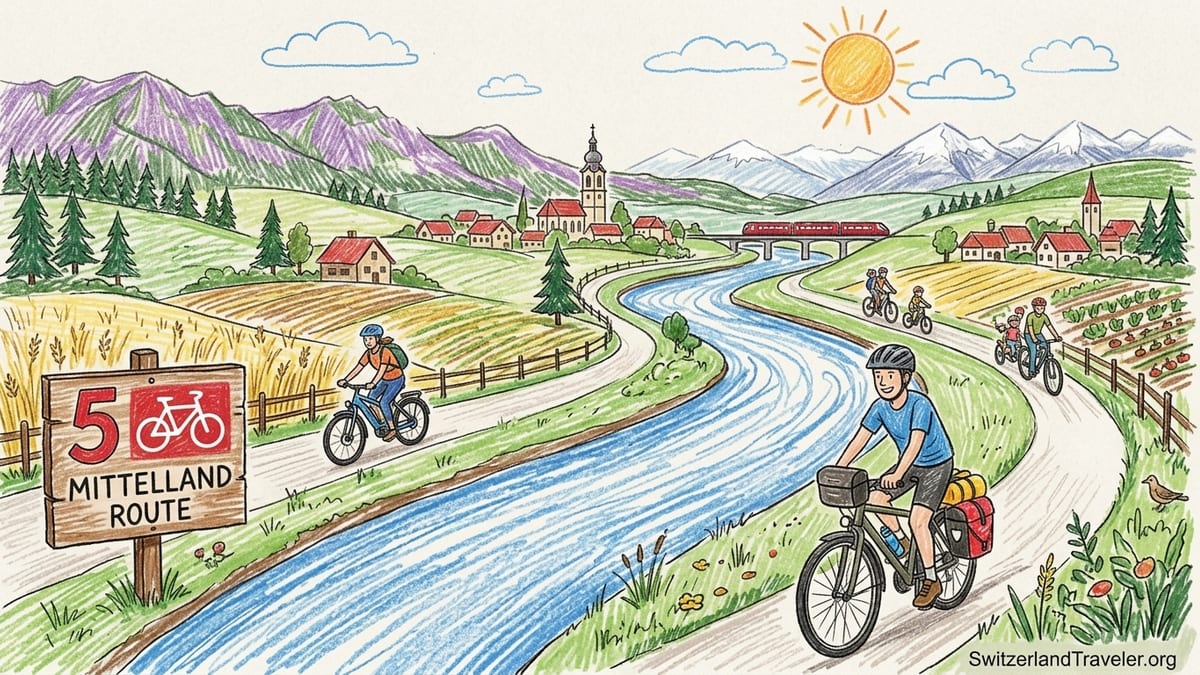
Understanding the Mittelland Route and the Aare Corridor
Switzerland’s Mittelland Route, signposted as National Cycle Route 5, runs roughly east to west between Romanshorn on Lake Constance and Lausanne on Lake Geneva. The central section that concerns most visitors follows the Aare valley through Olten, Aarau, Solothurn and then gradually swings toward the Seeland and the Three Lakes region around Biel/Bienne, Lake Biel, Lake Neuchâtel and Lake Murten. Through this corridor, the route is designed as a touring backbone rather than a mountain challenge, with comfortable daily distances and relatively modest climbs.
The Aarau to Solothurn stage of the Mittelland Route is marked at around 58 kilometres, while Solothurn to Ins near Lake Murten is around 62 kilometres. These are official figures from Switzerland’s national cycling signage and are close to what most GPS tracks confirm. Elevation gain varies slightly with small detours, but recreational riders can expect gentle undulations rather than sustained climbs. The route stays mostly in the wide Aare valley, using dedicated cycle paths, riverside tracks and quiet country roads through villages, fields and patches of riverside forest.
The character of the Mittelland landscape emerges clearly along this arc. Between Olten and Aarau you travel through one of Switzerland’s most densely used transport corridors, with the Aare squeezed between rail lines, the A1 motorway and compact towns. Beyond Aarau the valley opens and agriculture dominates, from vegetable plots in Aargau to cereal fields and cattle pastures closer to Solothurn. Past Solothurn the scenery shifts again as the Aare moves toward the Seeland, a patchwork of canalised rivers, low wetlands and flat fields created by historic river corrections, before the land flattens further toward the Three Lakes.
This combination of river, infrastructure and farmland makes the Mittelland feel very different from classic Alpine passes. You still see mountains on the horizon, especially the Jura to the north and the Bernese Alps on clear days, but most of your riding is on broad, open terrain. That is precisely why it works so well for cycling: gradients are forgiving, distances between rail hubs are short, and there are frequent opportunities to hop on a train, stop for an old-town stroll or cool off in the Aare.
Route Sections: From Olten and Aarau to Solothurn and Ins
Most visitors experience this part of the Mittelland Route in three logical sections: Olten to Aarau, Aarau to Solothurn, and Solothurn to Ins on the edge of the Three Lakes region. Olten and Aarau are both rail hubs with frequent direct trains from Zurich, Basel and Bern, so they are convenient starting or finishing points. From Olten, you can join the signposted Mittelland Route along the Aare and reach Aarau in roughly 20 kilometres, a comfortable half-day outing with time for coffee stops and a stroll through either town.
The official Aarau to Solothurn stage, around 58 kilometres, begins with urban cycling out of Aarau before slipping quickly into riverside tracks and small settlements like Rupperswil and Wildegg. Here the Aare valley is relatively narrow, with rail lines and hydroelectric plants occasionally close by, but traffic on the signed route is usually light. Near Rupperswil and Aarau you find gravel sections along the river, interspersed with asphalt cycle lanes through villages and short stretches on local roads. For many riders this is the first real taste of the Aare as a constant companion.
Approaching Solothurn, the river meanders more broadly, and the route often alternates between levee-top paths, minor roads through farmland and shady tracks in riparian forest. Solothurn itself, widely described by Swiss tourism offices as the country’s most beautiful baroque town, appears almost suddenly, with its domes and towers rising above the riverside promenade. The cycle route enters via the suburbs and crosses the Aare close to the old town, making it easy to roll directly into the cobbled centre for a drink or overnight stop.
From Solothurn to Ins, the official 62-kilometre stage continues along the Aare through low-lying land shaped by the Jura water correction projects of the 19th and 20th centuries. Between Solothurn and Büren an der Aare, cyclists share the valley with canoeists and river swimmers, with long, almost flat sections on flood dikes and farm lanes. Near Büren the historic Aare is partially replaced by the Nidau–Büren canal, and the landscape becomes progressively wetter and more open as you ride toward Lyss, Aarberg and eventually Ins. Here you sense the transition into the Seeland, where canalised rivers feed the trio of large lakes and vast vegetable fields stretch to the horizon.
Who the Route Suits: Recreational Versus Touring Cyclists
Because gradients along the Aare are gentle, the Mittelland Route between Olten and Ins works particularly well for recreational riders comfortable with distances of 30 to 60 kilometres per day. Strong day-trippers can manage the full 58 kilometres between Aarau and Solothurn or the 62 kilometres from Solothurn to Ins as single stages, while more casual cyclists might prefer to break them with an overnight stop or train shortcut. Families with older children who ride regularly can often handle 30 to 40 kilometres in this terrain if they factor in plenty of breaks, especially during summer heat.
For classic touring cyclists, this corridor is a natural part of longer itineraries across Switzerland or Europe. The Mittelland Route connects at multiple points with other national routes, including the Aare Route and Jura Route near Solothurn and the Three Lakes region around Biel/Bienne. Riders tackling a multi-day journey from Lake Constance to Lake Geneva often describe the Aarau–Solothurn–Ins arc as one of the easier segments, useful for recovering between hillier stretches near Winterthur or Lausanne. Surfaces are mostly asphalt with some well-maintained gravel, so touring bikes with 32 to 40 millimetre tyres or modern gravel bikes are ideal.
Performance-oriented road cyclists also use parts of this corridor for training rides, especially the flat stretches along the Aare between Olten, Aarau and Solothurn. However, pure road riders on narrow tyres should note that some official Mittelland sections use unpaved paths, particularly riverside dikes and forest tracks. In practice, many locals adapt the route slightly, switching to parallel minor roads where necessary. Visitors who prefer smooth surfaces can do the same, especially when following GPS tracks from road cycling apps that flag surface types in advance.
The biggest distinction is not fitness but expectations. Recreational riders will likely appreciate riverside pauses and town visits more than precise kilometre counts, while touring cyclists may optimise for daily distance and luggage logistics. The Mittelland Route allows both approaches. You can linger over a riverside lunch in Aarburg or a swim stop near Solothurn, or you can pedal steadily and cover 100 kilometres in a day by combining stages. The key is to treat the official distances as a framework rather than a rigid obligation.
Trains, Surfaces, Elevation and Luggage Logistics
One of the Mittelland corridor’s greatest strengths is how easily cycling and rail travel combine. Swiss Federal Railways allow bicycles on most categories of domestic trains as long as you have a valid bike ticket, and on many services no reservation is required. Current SBB guidance notes that reservations are mandatory on certain InterCity and international long-distance trains, particularly those marked with a bike symbol and an additional reservation indicator in the online timetable. Regional trains between Zurich, Olten, Aarau, Solothurn and Biel generally accept bikes without reservation, subject to available space, which makes short repositioning rides straightforward.
Typical prices at the time of writing include a national day ticket for bikes that costs a fraction of a passenger day pass and allows unlimited bike transport on participating services. Specific fares can change with annual timetable and tariff adjustments, so cyclists should check the latest SBB information and the current timetable when planning their journey. In practical terms, many riders simply buy a bike day ticket on the SBB Mobile app before they set out, then know they can hop on almost any regional or InterRegio train to shorten a stage, skip a suburban section or escape an approaching storm.
Surfaces along the Aarau–Solothurn–Ins corridor are varied but generally friendly. Expect long stretches of smooth asphalt cycle paths, local roads through villages and access roads along flood dikes, interspersed with compacted gravel or fine crushed stone. On the Aarau–Solothurn stage there are known gravel segments along the Aare that can become dusty in dry months but are usually rideable on anything from a touring bike to an e-bike. The Solothurn–Ins section, especially in the Seeland, features similarly mixed surfaces. Riders on loaded touring bikes report that tyres in the 32 to 40 millimetre range handle these conditions comfortably.
Elevation profiles underscore the route’s accessibility. Official SwitzerlandMobility maps show modest daily climbing, often well under 400 metres of total ascent between Aarau and Solothurn or Solothurn and Ins, spread across short rollers rather than long climbs. For riders who mainly cycle in flat countries like the Netherlands or Denmark, these days might feel “gently hilly” but never mountainous. The main challenge is length rather than altitude gain, which makes it easier to shorten a day by jumping on a train from intermediate stations like Wildegg, Lenzburg, Oensingen, Grenchen or Lyss.
Luggage logistics in the Mittelland are simpler than in remote Alpine valleys. Many mid-range hotels and guesthouses in towns such as Aarau, Olten, Solothurn and Biel are familiar with cyclists and offer lockable storage rooms or garages. Swiss rail stations in larger hubs often participate in luggage forwarding services, where you can check bags in at one station and collect them later at another, although these services sometimes exclude bulky bikes or require advance purchase. Dedicated baggage transfer services for cyclists operate in parts of Switzerland, but availability and conditions change regularly, so long-distance tourers should confirm options with current providers rather than assume doorstep transfers along the entire corridor.
E-bikes, River Swimming and Urban Interruptions
E-bikes are a natural fit for the Mittelland Route. The long yet relatively flat stages mean that pedal-assist riders can comfortably cover 60 kilometres in a day while still having the energy to explore towns or hike a short Jura trail in the late afternoon. In Switzerland, most rented e-bikes for casual touring fall into the 25 km/h pedal-assist category, so they can use the same cycle paths as normal bikes without special licensing. Several rental networks operate in and around the Mittelland, including outlets in rail stations and independent bike shops, though exact locations and models vary year by year.
Charging is rarely a problem in this corridor, because the density of villages, cafés and accommodation is high. Many hotels now advertise e-bike charging for guests, and numerous cafés or restaurants will allow you to charge a battery during a lunch stop if you ask politely and order something. E-bike riders should still carry the appropriate adapter for Swiss sockets and be prepared for stretches of 20 to 30 kilometres without obvious indoor stops, especially along the more rural parts of the Aare between towns.
One of the pleasures of riding the Aare corridor is the abundance of river swimming opportunities. In Solothurn, local tourism offices promote Aare swimming as a signature summer activity, with access points near the outdoor pool and popular “Stägli” steps by the riverside bars where people enter the water for short, controlled floats downstream. Similar informal swim spots exist near Aarau and between Büren and Biel, often marked by small grassy banks, ladders or simple steps. The Aare is a real river with strong currents, boats and cold water, so it is important to follow local safety advice, avoid swimming after heavy rain or at high water levels, and never underestimate the flow even on apparently calm days.
Urban interruptions are a reality in the Mittelland, though they are usually brief. Leaving Olten, Aarau or Solothurn, you may encounter mixed-traffic streets, roundabouts and suburban shopping strips before the route settles back onto quieter paths. Around industrial zones or hydroelectric plants, cycle paths sometimes run close to busy roads or cross multilane intersections. Local planning continues to improve cycling infrastructure, but visitors should be prepared for a small proportion of less idyllic kilometres, especially at the start and end of each day. Fortunately, rail stations at these same hubs allow you to start or finish stages outside peak urban traffic times.
Reading the Landscape: River Plains, Farms, Towns and Wetlands
Riding the Mittelland Route along the Aare offers a crash course in Swiss geography and land use. Between Olten and Aarau, the valley is tight and infrastructure-heavy: rail yards, motorway bridges and compact housing clusters press close to the river. The Aare itself is largely tamed here by dams and weirs, with several hydroelectric plants that channel water into power generation. Cyclists experience this in the form of levee-top paths, artificial channels and occasional detours around industrial sites.
As you roll beyond Aarau toward Solothurn, the valley opens into one of Switzerland’s archetypal agricultural zones. Fields of wheat, maize and potatoes stretch back from the river, punctuated by barns and small villages. You will frequently share narrow roads with farm tractors and local residents, but long sections of the Mittelland Route are segregated or marked as cycle-priority lanes, which keeps riding stress low. On clear days, the snow-capped Bernese Alps appear far to the south, providing a distant backdrop to the otherwise gentle landscape.
Solothurn itself illustrates the historic importance of the Aare as a trade and transport artery. The baroque old town occupies a strategic position where river traffic could be controlled, with bridges, fortifications and elegant townhouses clustered at a natural crossing point. Spending a night here between stages makes it easier to appreciate this history, especially if you walk along the riverside promenade in the evening and watch the current carry swimmers, boats and the occasional stand-up paddleboard downstream past the cathedral and towers.
West of Solothurn, the corridor gradually flattens further as the Aare and its side channels enter the Seeland. Canals like the Nidau–Büren channel, wide drainage ditches and low wetlands attest to a long history of water engineering intended to reduce flooding and reclaim fertile land. Cyclists on the Mittelland Route cross or follow several of these waterways before approaching Ins, where the land finally gives way to the broad surfaces of the Three Lakes. Here, the interplay between river, canal, lake and farmland becomes the defining feature of the landscape, and it is easy to understand why this lowland is often described as Switzerland’s vegetable garden.
One-day, Weekend and Multi-day Riding Options
For a single day of riding, one of the most realistic and rewarding options is Aarau to Solothurn. At about 58 kilometres, this stage balances distance with sightseeing, especially in longer summer daylight. You can arrive in Aarau by morning train from Zurich or Basel, follow the river west with picnic or café stops, and reach Solothurn by late afternoon with enough time for a walk through the arcaded old town and dinner by the river. If 58 kilometres feels long, consider starting further west, for example near Wildegg or Lenzburg, which you can reach easily by train.
Another straightforward day ride for moderately fit cyclists is Solothurn to Ins, the 62-kilometre stage toward the Three Lakes. Because the terrain here is very flat, this distance can pass relatively quickly, especially for e-bike riders or cyclists accustomed to full-day tours. The real reward is thematic: you watch the Aare transition from a classic river valley to a network of canals and wetlands, and by the time you reach Ins you are within easy reach of Lake Murten or Lake Biel beaches. From Ins station, regular trains can carry you back to Bern or Biel with your bike.
Weekend riders have several attractive combinations. One option is to start on Saturday morning in Olten, ride to Aarau for lunch and onward to Solothurn for an overnight stay, totalling around 70 to 80 kilometres depending on detours into town centres. On Sunday, you can continue a portion of the Solothurn–Ins stage, perhaps as far as Büren an der Aare or Lyss, then catch a train back. Another weekend approach is to base yourself in Solothurn and complete two out-and-back rides: east along the Aare toward Aarau one day, west toward Büren or Aarberg the next, which allows you to ride without luggage.
For multi-day touring, the Aarau–Solothurn–Ins stretch can anchor a larger traverse of Switzerland. Some riders link it with the Aare Route that continues downstream to Biel and eventually to the Rhine, while others combine it with Jura foothill routes to create a loop. Because rail access is so good, you can be flexible with start and end points. It is realistic, for example, to plan a three or four day trip from Winterthur to Lausanne using the Mittelland Route as the spine, with overnight stops in Aarau, Solothurn and the Biel or Neuchâtel area, adjusting daily distances with occasional train shortcuts if weather or energy levels demand.
Checking Closures and Planning Responsibly
Although the Mittelland Route is a national, well-established itinerary, detours and temporary closures are common. Construction on flood dikes, maintenance of hydroelectric installations, local roadworks and seasonal events can all divert the official line. Switzerland’s national mobility platform, SwitzerlandMobility, publishes detailed stage descriptions and maps that show updated routing, including marked detours and notices about closures. Before any article or printed guide is finalised, and again shortly before you ride, you should check the latest version of the Mittelland Route stages there rather than relying on older GPX files or printed maps.
Detours can be minor, such as a few hundred metres around a building site, or more substantial, rerouting cyclists to busier roads for several kilometres. Especially along the Aare, works on dams or dikes sometimes close pleasant riverside paths, forcing riders onto parallel local roads. These diversions seldom add significant climbing but can change the character of a stage, so it is worth reading route notes carefully and zooming in on planned alternatives. The most up-to-date information is usually in the official online mapping and, in some cases, on notice boards on-site.
Responsible planning in the Mittelland also means being realistic about daily distances, heat and wind. The open river plains can feel exposed during summer, with little shade on some flood dikes, and headwinds along the Aare or across the Seeland can slow progress more than expected. Carry sufficient water, plan refill points in towns and villages, and avoid assuming Alpine cool simply because you are in Switzerland. Local weather services and regional tourism offices provide accurate short-term forecasts, and many riders time their longest days for spring or early autumn when temperatures are milder.
Finally, while this corridor is well suited to independent travel, beginners may appreciate at least one overnight booking in advance, particularly in Solothurn or around the Three Lakes during busy holiday periods. This ensures secure bike storage and takes pressure off finding a room after a long day. If you rely heavily on train-and-bike flexibility, it also pays to avoid peak commuter times on popular routes, when carriages with bike spaces can fill quickly and some conductors may turn cyclists away once capacity is reached.
Best Easy Stage, Historic Towns, Family & E-bike Riding, and Extensions
For many visitors, the best easy stage along this corridor is Olten to Aarau. At roughly 20 kilometres, it provides an accessible introduction to Mittelland riding without demanding a full day in the saddle. You can start mid-morning, follow the Aare through Aarburg with its photogenic riverside fortress, and arrive in Aarau in time for lunch or an afternoon coffee in the traffic-calmed old town. Surfaces are mostly paved or well-compacted, gradients are minimal, and frequent train stations along the route allow for early exits if legs or weather dictate.
In terms of historic-town atmosphere, the highlight is undoubtedly the Aarau to Solothurn section. Beginning in Aarau, which has a compact old town with well-preserved painted eaves, you ride through river and farmland scenery before finishing in Solothurn’s celebrated baroque centre. This creates a narrative-rich day that connects two visually distinct towns through a full day’s riding. An overnight in Solothurn allows you to explore landmarks such as the cathedral, clock tower and arcaded market squares before continuing west or returning by train.
Families and casual e-bike riders may find the central stretch around Solothurn best suited to their needs. A practical option is to base in Solothurn and undertake shorter out-and-back rides of 20 to 30 kilometres along the Aare in either direction, returning by bike or occasionally by train. This keeps daily distances flexible while still offering plenty of variety, including riverside picnic spots, playgrounds near the path and swimming access in warm weather. E-bikes flatten what few hills exist and make it easier to handle unexpected headwinds, which can be crucial when riding with less experienced cyclists.
The most natural extension toward the Three Lakes is the official Solothurn to Ins stage, but riders keen to reach actual lake shores can continue from Ins toward Murten, Neuchâtel or Biel/Bienne. Short additional rides link Ins with lakeside towns where beaches and lakeside promenades invite end-of-ride swims and lakeside dinners. For example, riding from Ins to Murten adds another manageable day through flat farmland, after which regular trains can return you and your bike to Bern, Fribourg or Lausanne. If time is short, you can also complete only part of the Solothurn–Ins stage, such as Solothurn to Büren an der Aare or Aarberg, then use the rail network to leapfrog ahead or head home.
The Takeaway
Cycling the Mittelland Route along the Aare from Olten and Aarau through Solothurn to the edge of the Three Lakes is less about conquering mountains and more about understanding how Switzerland actually lives and works. It is a landscape of rivers, railways, vegetable fields and old towns, knitted together by a remarkably coherent cycling network and an even denser web of train connections. For recreational riders, weekend explorers, e-bikers and touring cyclists looking for realistic daily distances on mostly gentle terrain, it is an ideal setting.
By using the Aarau–Solothurn and Solothurn–Ins stages as flexible building blocks rather than fixed obligations, you can shape trips that match your interests, whether that means lingering in Solothurn’s baroque alleyways, hopping off the saddle for a float in the Aare or pushing on to the Seeland’s wide open fields and canals. With its mix of countryside and compact cities, the Mittelland proves that Switzerland’s cycling story does not begin and end with Alpine passes. It also lives down here along the rivers, where everyday Switzerland rolls by at handlebar height.
FAQ
Q1: How difficult are the Aarau–Solothurn and Solothurn–Ins stages for average riders?
Both stages are moderate in length, around 58 and 62 kilometres respectively, with generally gentle gradients. Average riders who are comfortable with 4 to 6 hours of relaxed cycling, including breaks, usually manage them well, especially in stable weather.
Q2: Can I ride these stages comfortably on a standard city bike?
A well-maintained city bike with several gears and reasonably wide tyres can handle most of the route, but some gravel and unpaved sections are more comfortable on a trekking or hybrid bike. If your city bike is heavy or has limited gears, consider shortening stages or using train shortcuts.
Q3: Do I need to reserve a space for my bike on Swiss trains along this corridor?
On many regional and InterRegio trains between Zurich, Olten, Aarau, Solothurn and Biel you do not need a reservation, although you still need a valid bike ticket. On certain InterCity and international services, a bike reservation is mandatory. Always check the current SBB timetable, which clearly indicates whether bikes are allowed and if a reservation is required.
Q4: Is it safe to swim in the Aare along the route?
The Aare is a strong, cold river and demands respect, but river swimming is an established local activity, particularly around Solothurn. Use official access points, follow posted safety information, avoid high water and never swim alone or under the influence of alcohol. Non-confident swimmers should limit themselves to supervised pools and shallow areas.
Q5: Are there many food and water stops along the Mittelland Route?
Yes. Towns and villages are relatively frequent, especially between Olten, Aarau and Solothurn, and again west toward Lyss and Aarberg. You can usually find bakeries, cafés, small supermarkets and public fountains, although some rural stretches require riding 15 to 20 kilometres between obvious options, so carrying extra water is sensible in hot weather.
Q6: What kind of accommodation is available for cyclists along this corridor?
In hubs such as Olten, Aarau, Solothurn, Biel/Bienne and around the Three Lakes, you will find a mix of hotels, guesthouses and simple pensions, many of which are experienced with cyclists and offer secure bike storage. Rural options exist in some villages but are less frequent, so if you want a quiet countryside stay it is worth booking ahead.
Q7: Is the route well signposted, or do I need to rely on GPS?
The Mittelland Route is part of Switzerland’s national cycling network and is generally well signposted with red route panels. However, in towns, at complex junctions or where temporary detours are in place, signs can be easy to miss. A GPS device or smartphone with offline maps and the official stage overview is a useful backup.
Q8: How suitable is the route for families with children?
Families with children who already ride confidently can enjoy shorter sections, especially near Solothurn or between small villages where traffic is minimal. Stages of 20 to 30 kilometres with plenty of breaks are realistic for many children. Parents should avoid longer stretches on busy roads and be prepared to use trains to shorten days if energy dips.
Q9: Are e-bikes allowed and easy to charge along the route?
E-bikes limited to 25 km/h pedal assist are common and allowed on the same cycle paths as regular bikes. Charging is usually possible at accommodations and frequently at cafés or restaurants if you ask. It is wise to start each day with a full battery and know where you might find indoor stops over the next 40 to 50 kilometres.
Q10: How can I find out about current detours or closures before I ride?
Before setting out, always consult the latest stage descriptions and maps for the Mittelland Route on Switzerland’s official mobility platform, which lists current detours, closures and on-the-ground route changes. Because construction and maintenance work can start or end quickly, it is worth checking again shortly before your travel dates.