

The gravel revolution around Bern is no longer theory on a tourism fact sheet. It lives in the legs, lungs and shaky forearms of anyone who points a drop‑bar bike into the folds of Gantrisch Nature Park. With Bern Welcome expanding its gravel offerings for 2026, new rentals in Burgdorf and the first Swiss Gravel Championships lighting up the capital, I went to see what the canton’s fresh gravel scene feels like from the saddle on a full day out in Gantrisch.
Choosing a Route in a Park Built for Gravel
Gantrisch Nature Park sits between Bern and Fribourg and now actively promotes around 300 kilometres of signposted gravel-bike routes alongside more than 350 kilometres of mountain-bike trails. The landscape is a mix of soft farmland, dark spruce forest and sudden limestone ridges. On paper it looks like gentle pre-Alps terrain. Up close it can feel far more rugged, especially once you leave the valley roads and follow the white-red waymarkers onto old farm tracks and forestry roads.
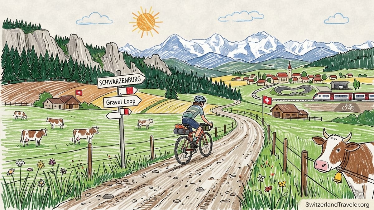
For this ride I wanted something that showed off the park’s new gravel ambitions rather than a token farm-lane loop. I picked the "Swiss Bike Park – Schwarzenburg Gravel Loop," a roughly 50 kilometre circuit that starts at the Swiss Bike Park above the Sense valley, drops into rolling farmland and returns on the opposite side of the river. Official information lists about 50.5 kilometres of distance and just under 1,200 metres of climbing, with several steep ramps scattered through the day. It sounded like a route that would punish sloppy pacing without turning into an alpine death march.
The loop is one of a growing menu of gravel tours that Bern Welcome is pushing for independent riders and guided groups, together with routes that link the Old Town of Bern to the Gürbetal and on to Thun or Schwarzsee. It is typical of the new style: largely unpaved, legal to ride throughout, designed to keep you off main roads while still passing farm shops, fountains and quiet villages. In other words, it is built for long days out rather than intervals.
Schwarzenburg, reachable by train from Bern in about 35 minutes with bikes carried on board, acts as a relaxed hub. The presence of the Swiss Bike Park gives the area a low-key but real bike culture feel: kids rolling pump tracks, local riders tweaking suspension, and a café that does not blink when muddy riders track dust across the terrace. It felt like the obvious place to begin a story about the canton’s new gravel identity.
Bike, Gearing and the Cost of Joining Bern’s Gravel Scene
To experience the scene the way many visitors will in 2026, I did not bring my own bike. Instead I took the train to Burgdorf in the Emmental and walked the short distance from the station to Rent a Gravel, the new local rental outfit that Bern Welcome is actively promoting. Their fleet focuses on modern gravel bikes with disc brakes, generous tyre clearance and, increasingly, electric assistance for riders who want the scenery more than the suffering.
I booked a mechanical gravel bike with 700c wheels, 40 millimetre tubeless tyres and a compact 2x drivetrain. The chainset was a 46/30 paired with an 11–34 cassette, which on paper sounds more than generous for a pre-Alps ride. The rental cost was listed at around 70 Swiss francs for a day, including helmet, saddle bag with spare tube and levers, and a simple top-tube bag. Prices may be adjusted slightly season by season, but day rates in this range are a realistic expectation around Burgdorf. Compared with broader Swiss bike rental offers that often charge 60–70 francs for an e-bike day rate, the pricing felt aligned with the market rather than an opportunistic tourist mark-up.
From Burgdorf I joined a short guided transfer into Gantrisch with a local operator that works with Bern Welcome. Riders who prefer to self-organise could just as easily pick up their rental, roll to the station and hop a train toward Bern and then Schwarzenburg, but starting closer to the park made sense on a tight autumn weather window. The idea was to ride the Schwarzenburg Gravel Loop as published, using the official GPS track downloaded in advance.
The choice of gearing proved important. On the lower valley sections and gentle farm roads, a 46-tooth outer ring gave a pleasantly brisk cruising speed. On the steeper forestry ramps around the Sense and in the hilly farm lanes near Riffenmatt and Längenberg, the 30-tooth inner ring paired with the 34-tooth cog still demanded out-of-the-saddle efforts. Recreational cyclists used to flatter cycle routes might find some of these ramps brutal without either a wider-range cassette or the backup of an electric motor.
First Pedals: Farm Roads, Quiet Traffic and the Alps on the Horizon
The Swiss Bike Park sits on the eastern side of the Sense valley. Rolling out from the parking area, the gravel loop almost immediately dives into single-lane farm tracks. The surface here was a classic Bernese mix: compacted fine gravel broken by short sections of chipped stone, with ruts formed by tractor tyres. After a dry spell in early autumn, dust hung in the air behind every passing farmer’s pick-up. Traffic, though, was remarkably light. Over the first hour we were passed by only three vehicles, all moving slowly and stepping wide around cyclists.
The official route first trends north through low, open fields where dairy cows watched with mild interest. The Bernese Alps start as a faint cut-out on the southern horizon, little more than an outline behind hazy air. The surface mix on this section was about 70 percent gravel or dirt and 30 percent tiny patches of tarmac linking farms or crossing villages like Niederscherli. The riding felt easy, the gradient barely perceptible, the speedometers cheerfully hovering above 25 kilometres an hour.
It is only after the route tips down towards the Sense river that the park reveals its real topography. A rapid descent on a slightly looser gravel road leads through spruce forest to a bridge near Steinenbrünnen. Here the Bernese Alps suddenly pull into focus. As the road bends and the trees thin, the skyline over the far side of the valley sharpens: saw-toothed peaks from the Stockhorn range across to the Gantrisch chain and on, in clear weather, glimpses of higher Bernese giants far beyond. It was around the 15 kilometre mark that I first felt the sense of riding through a genuine mountain foreland rather than a pretty farming basin.
Traffic remained minimal even when the loop touched slightly larger local roads. Bern’s gravel planners have been deliberate in threading side streets and farm access lanes rather than main connectors. For visitors used to sharing space with holiday traffic in major alpine valleys, the quiet of Gantrisch feels generous and deliberate, closer to a local commute than a tourist circus.
When the Rolling Terrain Starts to Bite
The published stats for the Schwarzenburg Gravel Loop list around 50 kilometres and a respectable, but not terrifying, vertical tally. On a planning screen this can look like a long but mellow morning. On the ground, the accumulation of short climbs hits much harder than expected. Each ramp alone is manageable. Together they add up to a ride that feels far more physical than the numbers suggest.
The first real test comes after crossing to the western side of the Sense and beginning the gradual rise toward Schwarzenburg. The gradient rarely exceeds eight per cent here, but the surface changes character. The fine, compact gravel gives way to chunkier stones, washboard ridges and sections where spring run-off has carved channels. Climbing seated on this texture means constant small impacts through the hands and core. My arms tired as much as my legs in this phase, and the thought occurred more than once that a suspension fork, often shunned by purist gravel riders, would have been welcome.
Beyond Schwarzenburg the loop continues into what the park describes as hilly landscape. In practice that means a relentless series of rollers between dairy farms and small patches of woodland. None of these rises look dramatic. A meadow ridge, a cluster of trees, a farmhouse perched a little above the valley floor. Yet the gradients on the farm tracks bite sharply, often in the low teens, and the surface under the tyres alternates between fine gravel, packed earth and, occasionally, a ribbon of smooth concrete poured for tractors. On one unmarked climb above Fultigen my GPS briefly flashed 17 per cent.
By the time the odometer passed 35 kilometres, the ride had the feel of a miniature one-day classic. There were no headline passes or famous cols, just an endless, wearing pattern of down, up, corner, repeat. The mental effect was as strong as the physical one. The map’s simple elevation profile had smoothed these undulations into a tidy curve. In reality every little hollow and crest added cognitive load. Pacing had to be gauged climb by climb, not just against a single, big objective.
Water, Food and a Navigational Mistake
Practicalities can make or break a gravel ride in Gantrisch as much as elevation gain. On this loop, water was surprisingly easy to find if you know what to look for. Many Swiss villages maintain public fountains with potable water, often on a square near the church or beside the main crossroads. Between Oberried and Schwarzenburg I refilled bottles twice from such fountains. In the high farmland zones, however, fountains become rarer and some are marked as non-potable due to their connection to cattle pastures.
Food stops require a little more planning. Schwarzenburg has bakeries and cafés that serve snacks, coffee and simple lunches. A stop there around the halfway mark works well. Beyond that, options thin out. A small village shop in Rüschegg provided an emergency supply of nut bars and dried fruit. Many riders will prefer to carry their own, especially on Sundays when rural shops often close. For those on guided tours, local operators usually build in a midday stop at a mountain inn or farm restaurant, where rösti, soup and cheese-heavy plates provide enough calories to fuel the afternoon’s rollers.
Despite downloading the official GPX track from the Gantrisch Nature Park site before the ride, I still made one navigation mistake. After a fast descent on a gravel farm lane above the Schwarzwasser, I missed a subtle left turn marked only by a small wooden bike-route sign half-hidden in grass. The GPS lagged for a few seconds, and by the time it beeped I had already rolled 300 metres too far down a paved lane that steepened alarmingly. Climbing back up cost maybe five minutes and a frustrating anaerobic effort. More importantly, it underlined a key lesson for Gantrisch: waymarking is generally good but cannot replace active navigation. A handlebar-mounted GPS unit or at least a secure phone mount is highly recommended, especially where tracks cross at odd angles.
Equipment-wise, my one real mistake was tyre pressure. Coming from smoother canal-path riding, I started the day with around 3.5 bar in 40 millimetre tyres, which felt zippy on tarmac but punishing on rougher gravel. The washboard sections and stony farm roads transmitted every vibration into hands and shoulders, leading to numb fingers well before the end. Midway through the ride I dropped pressure to closer to 2.5 bar, which transformed comfort without sacrificing much speed. In hindsight, starting softer would have been smarter and more in line with what local riders run on these surfaces.
Where an E-Bike Would Have Changed Everything
Bern’s gravel expansion is not just about analog bikes. E-gravel and e-MTB rentals are increasingly available, including in the Emmental and Burgdorf, where operators rent electric bikes and offer guided tours through the region’s hills. For parts of the Gantrisch terrain, especially for riders with limited training time, an e-bike would not just be a nice-to-have but a genuine enabler.
On the Schwarzenburg loop, there were three specific zones where pedal assistance would have made a dramatic difference. The first is the climb from the Sense up to Schwarzenburg on the western side. The combination of loose gravel and sustained moderate gradients forced me into low gears and a grinding cadence. An e-gravel bike would have flattened this into a pleasant, conversational ascent rather than a laboured push. The second is the cluster of steep ramps above Fultigen and Längenberg, where gradients spike into double digits without warning. Here, assistance would have turned moments of near-stall into smooth, seated spinning, especially for anyone carrying bikepacking bags.
The third zone is less obvious: the long, gentle false flats heading back toward the starting point. After hours of rollers, fatigue made these sections feel stubbornly slow. With an e-bike set on an eco mode, the psychological drag would ease. Riders could more easily stay together regardless of varying fitness levels, making the route more social and broadening its appeal beyond pure endurance cyclists.
Of course, e-bikes introduce their own logistics. Recharging is not typically available at every farm inn, and carrying a spare battery on this kind of rolling route might feel excessive. That said, daily distance and climbing on the Schwarzenburg loop are well within the range of modern e-gravel batteries if riders use assistance sensibly. For visitors considering Bern’s new guided multi-day gravel itineraries that link Gantrisch with the Emmental, e-assistance is already part of the offering, which makes higher-mileage days and bigger elevation totals realistic for mixed-ability groups.
Who This Route Really Suits
On paper, 50 kilometres with around 1,200 metres of climbing does not sound extreme. In practice, the surface mix and repeated ramps push the Schwarzenburg Gravel Loop closer to intermediate-plus territory. Strong recreational cyclists who ride regularly at home, tackle weekend group rides and are comfortable with a few hours in the saddle will likely find it challenging but satisfying. Those whose cycling experience is limited to flat riverside paths or urban bike lanes may be taken by surprise.
Technical difficulty is moderate. The route avoids anything that most riders would classify as singletrack. Instead, the challenge lies in loose stones, potholes, occasional muddy patches after rain and the need to pick a good line through tractor ruts. Confident bike handling helps, but you do not need mountain-bike skills. Good braking technique and comfort riding on variable surfaces at descent speeds of 30 to 40 kilometres an hour are more important than bunny-hopping roots.
Fitness is a bigger limiter than technique. Riders who can complete a three-hour road ride with shorter climbs at home will handle this loop, though they will likely feel it in their legs the next day. The stop-start nature of the hills and junctions also taxes cardiovascular fitness more than a single long climb would. There is no opportunity to settle into a steady tempo for an hour; instead, the ride is a series of two to ten minute efforts followed by brief recoveries.
For this reason, the route is better described as suitable for trained riders, or at least for recreational cyclists with some preparation, than for casual holiday pedallers. Those newer to cycling can absolutely enjoy Gantrisch, but they might choose flatter loops in the Gürbetal or shorter circuits near Belp that the park also signposts as gravel options, or opt for an e-bike on the hilly routes. Guided tours offered through Bern Welcome partners also match route choice to group ability, which removes some of the stress of overcommitting.
Weather, Seasons and What It Felt Like on the Day
I rode the loop in early October 2026, on a day typical of Bernese autumn. Morning temperatures hovered around 7 degrees Celsius in the valley, rising to the low teens by early afternoon. Skies began high and overcast, with filtered sun casting soft light across the pastures, then gradually broke into blue patches as the day wore on. Light northerly wind kept the air clear, sharpening the outlines of the Bernese Alps in the distance.
Weather shapes the gravel experience in Gantrisch more than a simple forecast might imply. After several dry days, many of the farm roads were dusty and loose on top, with pea-sized stones skittering under tyres. In wet conditions, these same tracks become slick and claggy, especially where cows had churned the surface. Forest sections in particular can hold moisture for days, generating muddy holes and slippery roots. On my ride the ground was just dry enough that mud was not a concern, but shaded patches still showed where previous showers had left darker, slightly softer earth.
The microclimate in the park varies with altitude. Cold air pools in the Sense valley and along shaded rivers like the Schwarzwasser, while sunny ridges warm quickly. Short glove liners and a gilet were welcome on descents in the first half of the day but felt unnecessary by mid-afternoon. Anyone planning spring or late autumn rides should think in layers and bring a lightweight shell for higher or more exposed sections, even when the forecast in Bern looks benign.
Visually, the October timing was a gift. Larches on higher flanks began to turn gold, mixed forests displayed a patchwork of yellows and reds, and low sun angles stretched shadows across the gravel, highlighting every rut. The Bernese Alps, still holding early season snow on upper slopes, acted as a constant visual anchor. They never dominated the skyline the way they do from Interlaken or Grindelwald, but rather floated above the nearer Gantrisch ridge, a reminder that this is a pre-Alpine landscape with real mountains just beyond.
The Takeaway
Riding gravel in Gantrisch Nature Park in 2026 feels like discovering a region in the middle of defining its identity. Bern Welcome’s push into gravel tourism, the new rentals in Burgdorf and the arrival of the first Swiss Gravel Championships in the capital show a canton leaning into the discipline rather than treating it as a passing fad. Out on the ground, the work already done is tangible: well-thought-out routes, intelligent use of farm and forest roads, and a sense that cyclists are guests who belong on this network rather than intruders.
The Schwarzenburg Gravel Loop delivered exactly what its description promised and more. It ran about 50 kilometres with roughly 1,200 metres of elevation gain, most of it on gravel or dirt, with only short connectors on quiet tarmac. The surface mix kept riding interesting without drifting into technical mountain biking, and traffic was so light that it was easy to forget major roads existed. Water and occasional food stops were available, but they required a bit of local knowledge or off-the-bike wandering.
Personally, I underestimated the cumulative effect of the rolling terrain. What looked like a moderate, scenic loop on the elevation profile became a ride that demanded real pacing and a willingness to grind up repeated short climbs. The navigational slip near the Schwarzwasser and the initial mistake with tyre pressure were reminders that this is still a semi-wild environment for riders, not a theme park circuit. It rewards preparation and a small margin for error.
If I were to ride Gantrisch again, I would change three things. First, I would start with lower tyre pressures to prioritise comfort over marginal gains on tarmac. Second, I would tweak gearing further, perhaps adding a wider-range cassette, to make the steepest farm-road pitches more sustainable. Third, I would consider riding an e-gravel bike for a second lap or a linked multi-day route into the Emmental, not to avoid effort but to turn the focus more fully onto the views, farm life and the quiet rhythm of this pre-Alpine landscape as Bern’s gravel era gathers pace.
FAQ
Q1. How long is the Schwarzenburg Gravel Loop in Gantrisch Nature Park?
The official Schwarzenburg Gravel Loop is roughly 50 kilometres long, starting and finishing near the Swiss Bike Park above the Sense valley.
Q2. How much climbing should I expect on this route?
The loop includes in the region of 1,200 metres of elevation gain, spread across many short climbs rather than one or two big passes.
Q3. What type of bike is best for gravel riding in Gantrisch?
A dedicated gravel bike with 35 to 45 millimetre tyres and disc brakes is ideal. A hardtail mountain bike also works, though it may feel slower on smoother sections.
Q4. Can I rent a gravel bike or e-bike near Gantrisch?
Yes. In 2026, Burgdorf in the Emmental and other nearby hubs offer gravel and e-gravel rentals that visitors can use to access Gantrisch and surrounding regions.
Q5. Is the Schwarzenburg Gravel Loop suitable for beginners?
It is better suited to reasonably fit recreational cyclists with some experience on hills. Complete beginners may find the repeated climbs and rougher sections demanding.
Q6. What is the road and surface mix like on this route?
Expect a blend of compact gravel, rougher stony farm roads, forest tracks and short paved connectors through villages, with unpaved surfaces clearly in the majority.
Q7. When do the views of the Bernese Alps appear on the ride?
The Bernese Alps first come into clear view after descending toward the Sense river on the eastern side, then remain a recurring backdrop on higher open sections.
Q8. Are there places to refill water and buy food on the loop?
Yes. Public village fountains often provide potable water, and towns like Schwarzenburg offer cafés and bakeries, though hours can be limited on Sundays and holidays.
Q9. Do I need a guide or can I navigate the gravel routes myself?
You can ride self-guided using official GPX tracks, but a guide can help with route choice, local shortcuts, weather decisions and finding the best food and view stops.
Q10. What would you change before riding Gantrisch’s gravel routes again?
I would start with lower tyre pressures, consider slightly easier gearing, and decide in advance whether to ride a standard gravel bike or an e-gravel for longer linked routes.