


Across Switzerland’s protected parks, hiking routes range from pushchair friendly riverside paths to serious multi day crossings of wild high country. This guide brings together some of the most rewarding hikes in Swiss National Park, the UNESCO Biosphere Entlebuch, Parc Ela, Val Müstair and the Jura parks, grouped by type of experience: easy family walks, wildlife focused trails, lakeside routes, high Alpine hikes and multi day itineraries. For each, you will find typical distances, elevation changes, how to get there by public transport and the main seasonal limitations to help you plan a safe and realistic trip.
How Swiss Parks Structure Their Hiking Networks
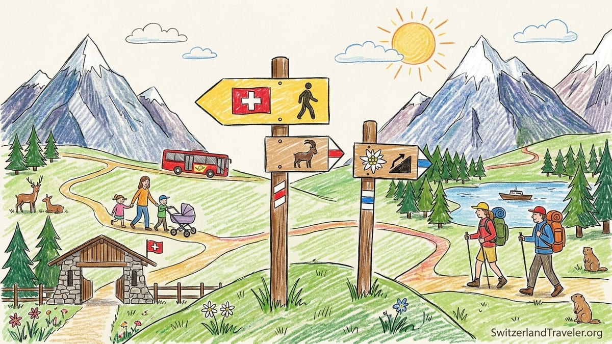
Switzerland’s parks are designed to be explored on foot. The official Swiss parks network now indexes hundreds of signposted routes of varying difficulty, while Swiss National Park alone maintains roughly 100 kilometres of marked paths spread across 21 official routes. In practice, that means visitors can arrive by public transport in a mountain village, follow yellow or white signposts directly from the station and be on a well maintained path within minutes, whether they are pushing a stroller or carrying a full multi day pack.
Trail grading is consistent across the country. Standard hiking trails are marked with yellow signs and usually involve clear paths and modest exposure. More demanding mountain hiking routes are marked with white red white paint flashes on rocks and posts, and Alpine routes with white blue white markings where you may cross scree or easy rock steps. In Swiss National Park and the higher parts of Parc Ela, some routes are classified at this upper end, which affects when they open in spring and whether they are suitable for less experienced walkers.
Seasonal closures are especially important in protected parks. In the Swiss National Park, all trails are normally closed from around mid November to the end of May to protect wildlife in winter and during the sensitive spring period. In Entlebuch’s raised bogs and Parc Ela’s high passes, snow can linger into June, meaning that some circuits open later than low valley walks in the Jura or Val Müstair. Always check current conditions locally before setting off, especially early or late in the season.
Because these areas are designated for gentle, low impact tourism, car access is often limited or discouraged. Instead, the hiking infrastructure is integrated with Switzerland’s public transport. Postbuses connect to trailheads in Val Müstair and Swiss National Park, while regional trains reach the biosphere villages of Entlebuch and the Jura valleys. Many classic routes are deliberately planned to start and end at different bus stops or train stations, making one way hikes simple without needing to return to a parked car.
Easy Family Walks in Swiss Parks
For families and casual walkers, the UNESCO Biosphere Entlebuch between Lucerne and Bern is an ideal introduction to Swiss park hiking. Short themed trails around Heiligkreuz or Marbach typically range from 2 to 5 kilometres with less than 150 metres of ascent, and many start directly from a Postbus stop or mountain cable car station. Paths here wind through flower rich meadows and light forest, with occasional playgrounds and picnic fire rings that make it easy to break up the walk with young children.
One representative example in Entlebuch is a loop above the village of Sörenberg, reachable by Postbus from Schüpfheim. A typical family circuit might be around 4 kilometres with 120 metres of gentle elevation gain, following gravel and packed dirt paths that remain manageable in normal trainers in dry weather. In summer, mountain restaurants often operate along these routes, meaning parents can promise an ice cream or a plate of fries at the end of the walk as a very concrete motivator for tired youngsters.
In Val Müstair on the eastern edge of Switzerland, an accessible themed trail known locally as “A la riva dal Rom” follows the banks of the Rombach river through the Biosfera reserve. Sections can be shortened or extended according to family energy levels, but a common option is to walk 3 to 4 kilometres with minimal elevation change along a broad riverside path, then catch a Postbus back from the next village. Information panels explain local wildlife and river ecology in simple language, which helps keep older children engaged while younger ones throw stones in the water.
Even the rugged Jura parks offer gentle introductory routes. In the Parc Jura vaudois above the Vallée de Joux, for example, families can stroll on a short nature trail near the Sapin à Siméon viewpoint or along the lakeshore paths beside Lac de Joux. These outings are usually less than 5 kilometres with rolling ups and downs of 100 metres or so and can be combined with a visit to a lakeside café. Thanks to the relatively low altitude of around 1,000 metres, these paths are often snow free from April to November in most years, although a cold spring can delay full opening.
Wildlife and Nature Interpretation Trails
Swiss National Park in the Engadine is the country’s flagship destination for wildlife focused hiking. Here, animals and natural processes are given priority, and visitors stay strictly on marked paths. A good entry level route is the Val Trupchun trail, which follows a valley famous for red deer. The classic version starts from the village of S-chanf, accessible by train, and forms a loop of roughly 14 kilometres with about 400 metres of ascent. Much of the route follows a wide forest track that is manageable for fit older children, and in September and early October many hikers come specifically to hear the roaring of the stags during the rut.
The park’s interpretive paths add context to the scenery. Signs in several languages explain how forests regenerate after avalanches, how marmots and ibex use the rocky slopes and why certain areas are left untouched by forestry. Another representative route, shorter but steeper, is the hike into Val Cluozza, around 13 kilometres with 900 metres of elevation gain. It leads to a simple mountain hut where you can stay overnight, increasing your chances of spotting wildlife in the quiet evening or early morning hours when day visitors have gone.
Beyond Swiss National Park, the Doubs valley within the Jura parks is a prime area for riverside wildlife watching. Paths running along the Doubs between towns such as St Ursanne and Soubey typically cover 10 to 15 kilometres with only about 200 to 300 metres of ascent, following the river in a green, wooded gorge. Birdlife is rich here, and themed information boards along some sections describe fish species, river management and the cultural history of the valley. Hikers often spot herons and sometimes kingfishers on calm summer mornings.
In Parc Ela and Val Müstair, several themed trails have been created to highlight specific natural features. Short nature paths in Parc Ela, for example above the Albula valley, might involve a 6 kilometre loop with 250 metres of ascent past flower filled pastures and larch woods, with panels explaining traditional Alpine pasturing and the geology of the surrounding peaks. In Val Müstair, easy walks through Valchava’s meadows or along forest edges offer realistic chances of seeing roe deer at dawn or dusk, although patience and quiet walking are essential. Because these routes often cross livestock pastures, families should be prepared to keep dogs on a lead and give cattle a wide berth.
Lake and Riverscape Hikes
For many travelers, the combination of water and mountains defines the Swiss landscape, and the parks network offers numerous routes where you follow lakeshores or rivers for most of the day. In the Jura Vaudois Nature Park, a classic example is a loop around part of Lac de Joux, the region’s largest natural lake. A representative day outing might be 12 kilometres with about 200 metres of mainly gentle ascent, starting from Le Sentier train station and following the lakeside promenade and forest paths to the far end of the lake before returning by train from another village. Families can break up the route at swimming piers and picnic spots, and cafés in lakeside villages provide shelter if the weather turns.
Within the broader Jura parks, another rewarding riverscape hike follows the Doubs between St Ursanne and Soubey. This section, sometimes used as part of the long distance Trans Swiss route, is around 15 kilometres with modest undulations of roughly 250 metres. The entire hike can be completed in 4 to 5 hours of walking, and both endpoints are linked by Postbus services, so you can hike one way along the river and ride back. The path is generally easy underfoot but can be muddy after heavy rain, so sturdy walking shoes with decent grip are advisable even though the terrain is not technically challenging.
In Parc Ela, lakes are smaller and higher, often reached by a climb and then encircled on narrow paths. A typical “see and return” hike would head from a pass road or mountain village up to a small Alpine lake at around 2,300 metres. Distances might be 8 to 10 kilometres round trip with 500 to 700 metres of ascent. Because many of these routes begin from the Albula or Julier pass roads, hikers can arrive by Postbus and start walking directly from the pass stop. Snow can linger here into early July, so plan lake hikes in Parc Ela for mid summer to early autumn if you want dry paths.
In Val Müstair, the wild valley of Val Costainas offers a blend of streamside walking and small lakes in a more secluded setting. A representative day hike might total 12 kilometres with 600 metres of ascent, starting from a bus stop in one of the valley villages. The path climbs through forest, passes traditional wooden barns and eventually reaches small tarns and open meadows near the treeline. Late summer and early autumn are particularly attractive periods here, when the larch forests turn golden and the risk of afternoon thunderstorms is lower than during the peak heat of July.
High Alpine Trails in Swiss National Park and Parc Ela
Experienced hikers seeking more demanding terrain will find plenty to challenge them in Swiss National Park and Parc Ela. Within the national park, a few of the 21 official routes are rated as Alpine, meaning that they involve steeper, rockier paths where surefootedness and a head for heights are essential. One well known high route runs from Chamanna Cluozza over a high pass to Zernez, covering roughly 16 kilometres with more than 1,000 metres of ascent and descent combined. The path traverses steep slopes and loose scree in places, and in early season old snowfields can persist on north facing aspects, so this hike is best attempted between late July and early September in most years.
Parc Ela, the largest regional nature park in Switzerland, spans several high passes and mountain groups in the Albula Alps. A representative high trail in this park could involve crossing from one valley to another over a pass such as Fuorcla da Sur or a similarly high col. A full day outing might reach 2,800 metres, covering 15 kilometres with 900 metres of ascent. These routes often start near mountain villages like Bergün or Savognin, which are served by regional trains and Postbuses, and climb on red and white marked mountain trails into rocky basins framed by jagged peaks. Because of the elevation, snow can linger into July, and thunderstorms are a real concern on hot afternoons, so early starts and a flexible plan are important.
High Alpine trails in both parks reward hikers with close up views of glaciated peaks, scree slopes and high meadows that remain snow free for only a few months each year. Marmots whistle from boulder fields, and chamois or ibex are often seen browsing on distant ridges. Underfoot, paths can be narrow and occasionally exposed, with sections where hiking poles are helpful but free hands are needed for balance. Hikers should be comfortable with long days of 6 to 8 hours of walking and carry sufficient warm and waterproof clothing even in the height of summer, since weather at 2,500 metres and above can change suddenly.
What distinguishes these high Alpine routes from easier park hikes is not only the physical demands but also the remoteness. Once you commit to a pass, retreat options are often limited, and in bad visibility it can be easy to stray from the correct line. In Swiss National Park, regulations require hikers to remain on marked paths at all times and wild camping is forbidden, so you must be confident that you can complete the planned route within daylight hours or break it with a stay in one of the designated huts. Parc Ela is less strictly regulated but still expects visitors to respect marked trails and avoid disturbing wildlife, especially during the sensitive early summer period when young animals are born.
Multi Day Routes Across Swiss Park Landscapes
Multi day hikes offer a deeper immersion in the landscapes and rhythms of Switzerland’s parks. In the Jura Vaudois, for example, it is possible to combine existing national and regional routes into a two or three day crossing that forms a rough circuit of the park. One popular approach is to link sections of the Jura ridge route with the “Route du Pied du Jura” to create days of around 15 to 20 kilometres each with 600 to 900 metres of ascent. Hikers stay overnight in small inns in villages such as Marchairuz or Vallée de Joux, carrying only light packs and relying on public transport at the start and end of the trip.
Within Swiss National Park, strict protection rules mean that overnight options inside the park boundary are limited to a handful of mountain huts and nearby villages such as Zernez or Scuol just outside the core zone. A realistic two to three day itinerary might involve hiking from Zernez into Val Cluozza for a night at Chamanna Cluozza, then continuing via a high pass to another village or back to the Engadine valley. Daily distances would typically range from 12 to 18 kilometres with cumulative ascents of 800 to 1,200 metres, suitable for fit and experienced hikers who are comfortable walking 5 to 7 hours per day.
Parc Ela is particularly well suited to longer park to park style treks. For instance, hikers can follow a multi day route that links the Albula valley with other regional parks, spending three or more days crossing high passes, staying in simple mountain inns or huts along the way. A typical stage might begin in a village served by the Albula railway, climb 900 metres over 8 kilometres to a pass, then descend another 7 kilometres to the next overnight stop, making for a 15 kilometre day. This type of itinerary can be combined with scenic train travel to and from different valleys, so you return to your starting city, such as Zurich or Basel, without retracing your steps on foot.
Even the smaller Val Müstair and Entlebuch parks lend themselves to multi day traverses. In Val Müstair, a two day mini trek could combine a day in the river valley with a second day climbing into a side valley such as Val Costainas, staying overnight in a small guesthouse in one of the villages. Daily distances of 10 to 14 kilometres with 500 to 800 metres of ascent make this accessible to fit families with teenagers. In the Entlebuch, hikers might link together two or three themed paths and ridge walks between villages connected by train or Postbus, letting them experience raised bogs, karst landscapes and panoramic viewpoints over the Alps in a long weekend without needing a car.
Planning, Seasons and Public Transport Logistics
Planning a hike in Swiss parks begins with choosing the right season. For the high routes in Swiss National Park and Parc Ela, the main hiking window typically runs from late June to early October, with July to September offering the most reliable snow free conditions. Family walks in the Jura parks and Entlebuch can start earlier, often from April, though late cold snaps can bring fresh snow to higher ridges. Autumn is a particularly attractive time in Val Müstair and Parc Ela, when larch forests shift to gold and crowds thin out, though daylight hours are shorter and mornings colder.
Public transport access is a major practical advantage. For example, visitors can travel from Zurich to the Engadine by intercity train and change to a regional train for Zernez, the gateway to Swiss National Park, in around three hours. From there, yellow Postbuses serve various trailheads at park entrances. Similarly, Entlebuch lies on the rail line between Lucerne and Bern, with at least half hourly trains to villages such as Schüpfheim and Entlebuch, where local buses connect to smaller trailheads. In the Jura, regional trains reach St Ursanne and Vallée de Joux, while Postbuses climb to passes like Col du Marchairuz, providing car free access to high starting points.
When choosing specific routes, study not only distance but also elevation gain, expected walking time and the terrain type. A 12 kilometre riverside walk along the Doubs with 200 metres of ascent is a very different day from a 12 kilometre high pass crossing with 900 metres of climbing on rocky paths. Switzerland’s signposts usually provide time estimates between junctions, which many hikers find more useful than raw distances. For planning, allow for breaks, photo stops and a comfortable margin to reach the bus or train at the far end of your route without rushing.
Finally, expect some costs specific to park hiking. While walking itself is free, cable cars, chairlifts and mountain trains used to reach some trailheads can be expensive, with return journeys often costing the equivalent of a substantial city museum visit for a family. Many visitors offset this by purchasing regional travel passes or using half fare cards. Mountain huts and simple inns along multi day routes typically charge per person for half board, which includes dinner and breakfast; this can be a significant budget item but also an unforgettable part of the Swiss park experience.
FAQ
Q1. When is the best time of year to hike in Swiss National Park and Parc Ela?
The most reliable period for higher routes in Swiss National Park and Parc Ela is usually from late June to early October, with July to September offering the best balance of snow free paths and stable weather. Lower valley and forest walks may be possible slightly earlier or later depending on snowfall and spring thaw.
Q2. Are the family walks in Entlebuch and the Jura parks suitable for strollers?
Some short themed trails and lakeside promenades in Entlebuch and the Jura parks follow wide gravel or paved paths that can handle sturdy strollers, but many routes include uneven sections, steps or narrow forest tracks. For families with strollers, it is worth checking local descriptions for explicit stroller friendly labeling and being ready to carry or turn back if the path becomes too rough.
Q3. Do I need special permits to hike in Swiss parks like Swiss National Park or Val Müstair?
For day hikes on marked trails, no special permits are required in Swiss parks. However, in Swiss National Park visitors must follow strict rules such as staying on signposted paths and not bringing dogs, and wild camping is forbidden. In other parks like Val Müstair or Parc Ela, dogs may be allowed on a lead, and overnight stays are limited to official camping areas, huts or guesthouses.
Q4. How challenging are the typical lake and riverside hikes in these parks?
Most lake and riverside hikes in Entlebuch, Val Müstair and the Jura parks are moderate, with distances of 8 to 15 kilometres and elevation gains of 200 to 400 metres on generally good paths. They are well suited to reasonably fit walkers in regular hiking shoes, but can feel strenuous for beginners if undertaken at a fast pace or in very hot weather, so planning adequate breaks is important.
Q5. Can I rely entirely on public transport for multi day hiking routes?
In many cases yes. Multi day routes in Swiss National Park, Parc Ela, Val Müstair, Entlebuch and the Jura parks are often designed to start and end in villages served by trains or Postbuses. Some high passes and remote valleys may have limited bus schedules, especially outside the main summer season, so it is essential to check current timetables and avoid missing the last connection of the day.
Q6. What basic equipment should I bring for park hikes in Switzerland?
At a minimum, hikers should carry sturdy footwear with good grip, weatherproof layers, sun protection, a map or reliable navigation app, sufficient water and snacks. For higher or longer routes, trekking poles, a warm insulating layer and a lightweight first aid kit add a useful safety margin. Even in summer, temperatures can drop quickly at altitude or in storms.
Q7. Are there marked wildlife watching trails suitable for children?
Yes. In Swiss National Park, routes such as Val Trupchun are known for red deer and other wildlife sightings, and include information boards that help children understand what they are seeing. In Val Müstair and Entlebuch, themed nature trails along rivers and through meadows are specifically designed to be engaging for younger visitors with short distances and frequent stopping points.
Q8. How early in the year can I plan a hike in the Jura parks?
Because the Jura parks sit at lower elevations than the high Alps, many valley and ridge routes become accessible between April and May in an average year. However, late snowfalls are not uncommon and some north facing slopes or shaded gorges can remain icy into early spring, so hikers should be prepared for mixed conditions and consult local updates before heading out.
Q9. What are the main safety concerns on high Alpine trails in Parc Ela and Swiss National Park?
The main concerns are lingering snowfields, loose scree, sudden weather changes and the physical demands of sustained climbs and descents at altitude. Slips on wet rocks or snow can have serious consequences, and fog can make route finding difficult above the treeline. Carrying suitable clothing, checking forecasts carefully and choosing routes that match your experience level are key safety measures.
Q10. Can I combine hiking in these parks with scenic train journeys?
Yes, many of these parks are accessible via some of Switzerland’s most scenic railway lines. Parc Ela connects with the Albula railway, Entlebuch lies between Lucerne and Bern, and Swiss National Park is reached from the Engadine line. This makes it easy to create itineraries where you hike by day and enjoy panoramic train rides to or from your starting and ending points.